Humber 2100+

Humber 2100+ is a partnership working on a new long-term strategy to manage tidal flood risk in the Humber region over the next 100 years.

There are over half a million people and thousands of businesses within the Humber 2100+ study area, as well as thousands of hectares of land, important industry, and infrastructure. It is also an internationally important natural asset for both people and wildlife. However, a substantial portion of this region is at risk of flooding during an extreme flood event.

As sea level rise accelerates, severe flooding will happen much more often, and we need to rethink how we manage the impacts so communities can continue to thrive.

To find out more about the background of this work, and why it's so important, explore the information bar or click here. Remember to check for the Latest News updates at the bottom of the page, and opportunities to get involved!
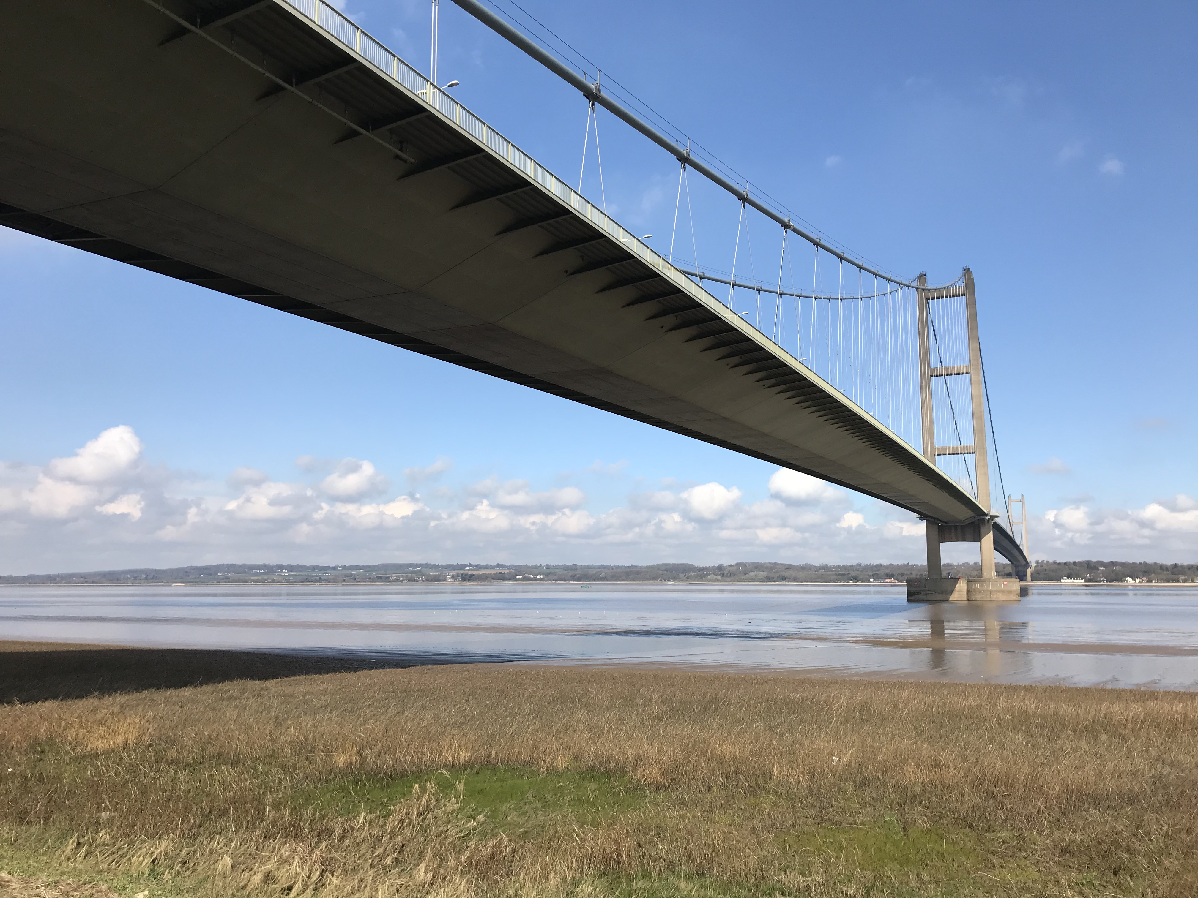


View of the Humber Bridge from the south bankView of the Humber Bridge from the south bank


Get involved now!

Local people, businesses and other interested parties will be able to participate in the development of the new Humber Strategy. We will engage and consult at key decision points and encourage you to get involved and help us shape the future of the Humber Estuary. We want to know more about you, the people, communities and organisations that this strategy will reach.

We want you to Register and Subscribe, so we can notify you of the latest news and updates for Humber 2100+.

If you've already got ideas you want to share with us, use the "tell us what you think" tool below. Or, if you have a question, use the "ask a question" tab below. We want to grow a community around the Humber 2100+ strategy and would love to share your ideas and questions with everyone else, but we will always ask you first.


Check your flood risk and prepare

Climate change is one of the biggest global threats we face. Globally, intense storms are becoming more frequent and climate change is already increasing sea levels around the UK coast. Although we work tirelessly to reduce the risk of flooding, we can never eliminate the risk completely.

With large areas around the Humber at risk of tidal flooding, it is important for us to work together to ensure that communities and businesses are better prepared for flooding.

In order for the Humber to thrive and continue to be a great place to live and work, the partnership is committed to working with others and the wider community to help lessen the impact that flooding can have on homes, land and businesses on and around the estuary.

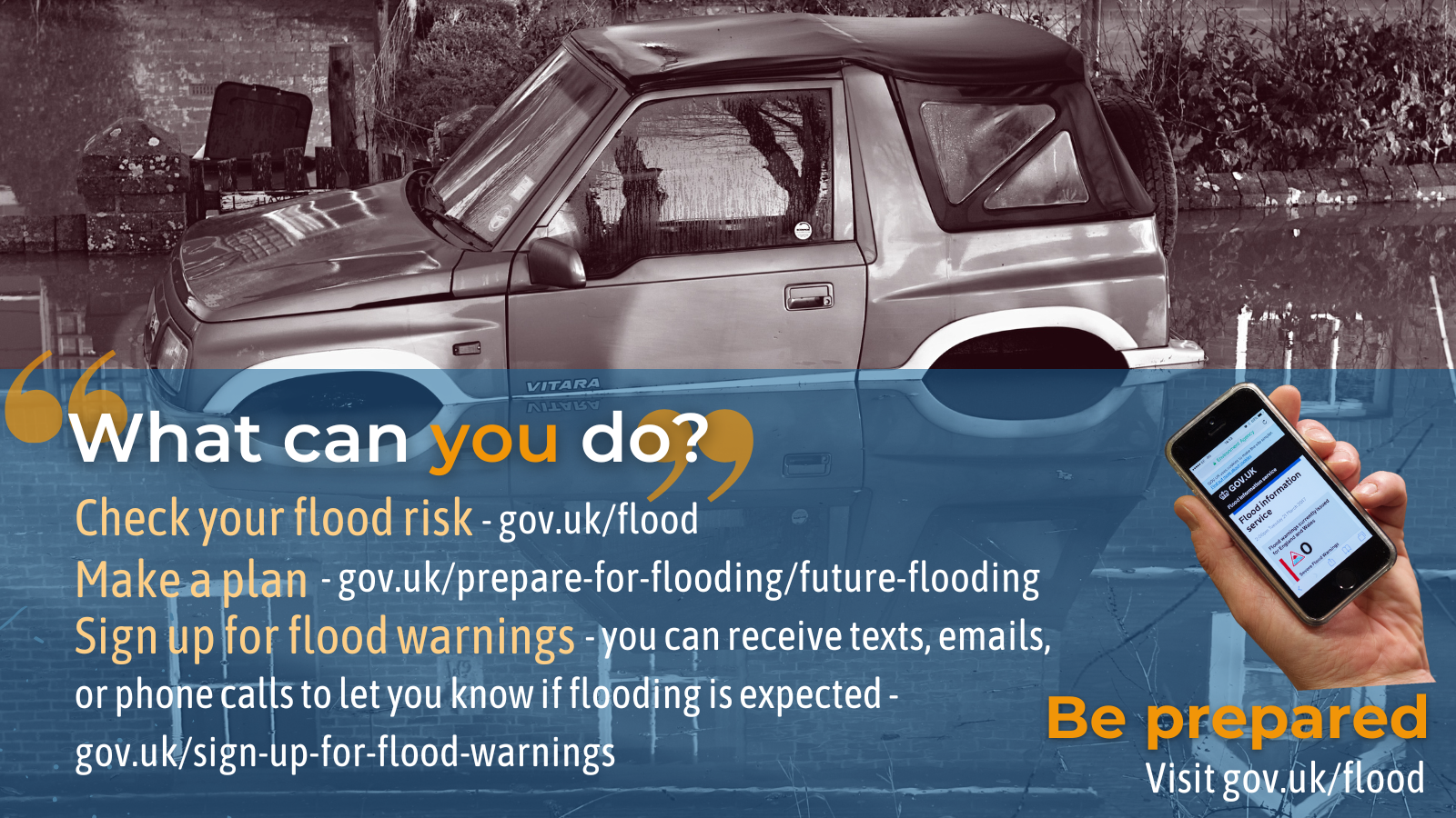
What you can do to be better prepared:


Image of a car submerged in water


Humber 2100+ is a partnership working on a new long-term strategy to manage tidal flood risk in the Humber region over the next 100 years.

There are over half a million people and thousands of businesses within the Humber 2100+ study area, as well as thousands of hectares of land, important industry, and infrastructure. It is also an internationally important natural asset for both people and wildlife. However, a substantial portion of this region is at risk of flooding during an extreme flood event.

As sea level rise accelerates, severe flooding will happen much more often, and we need to rethink how we manage the impacts so communities can continue to thrive.

To find out more about the background of this work, and why it's so important, explore the information bar or click here. Remember to check for the Latest News updates at the bottom of the page, and opportunities to get involved!


View of the Humber Bridge from the south bankView of the Humber Bridge from the south bank


Get involved now!

Local people, businesses and other interested parties will be able to participate in the development of the new Humber Strategy. We will engage and consult at key decision points and encourage you to get involved and help us shape the future of the Humber Estuary. We want to know more about you, the people, communities and organisations that this strategy will reach.

We want you to Register and Subscribe, so we can notify you of the latest news and updates for Humber 2100+.

If you've already got ideas you want to share with us, use the "tell us what you think" tool below. Or, if you have a question, use the "ask a question" tab below. We want to grow a community around the Humber 2100+ strategy and would love to share your ideas and questions with everyone else, but we will always ask you first.


Check your flood risk and prepare

Climate change is one of the biggest global threats we face. Globally, intense storms are becoming more frequent and climate change is already increasing sea levels around the UK coast. Although we work tirelessly to reduce the risk of flooding, we can never eliminate the risk completely.

With large areas around the Humber at risk of tidal flooding, it is important for us to work together to ensure that communities and businesses are better prepared for flooding.

In order for the Humber to thrive and continue to be a great place to live and work, the partnership is committed to working with others and the wider community to help lessen the impact that flooding can have on homes, land and businesses on and around the estuary.

What you can do to be better prepared:


Image of a car submerged in water


  • Beckingham Marshes - meeting the reservoir compliance rules

    Work to determine the best means of repairing the sluice gate at Beckingham Marshes is continuing. The project will continue to progress measures to implement remedial works to uphold the standards of the Reservoir Act 1075.

    A single stage business case is being developed which is aimed at reviewing, repairing, or potentially replacing a dewatering structure that is coming to the end of its life. investigation works and analysis are ongoing and supporting the funding allocation by outlining costs
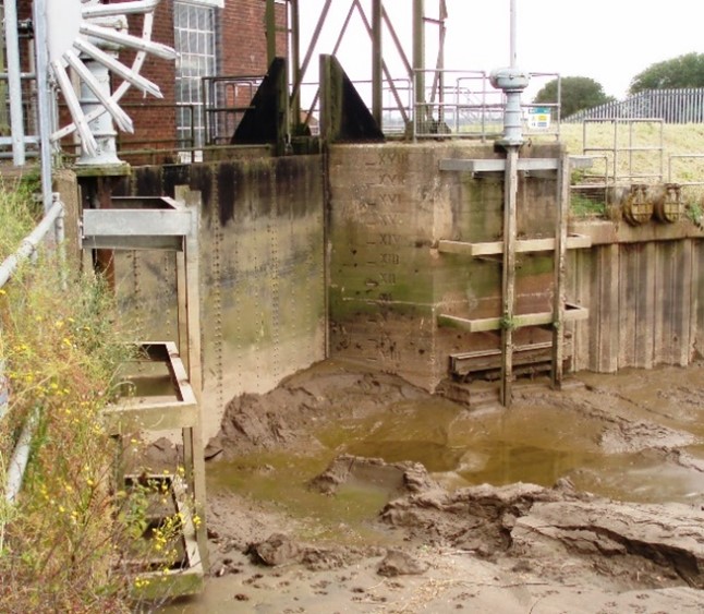


    Work to determine the best means of repairing the sluice gate at Beckingham Marshes is continuing. The project will continue to progress measures to implement remedial works to uphold the standards of the Reservoir Act 1075.

    A single stage business case is being developed which is aimed at reviewing, repairing, or potentially replacing a dewatering structure that is coming to the end of its life. investigation works and analysis are ongoing and supporting the funding allocation by outlining costs


  • Barton to New Holland Tidal Flood Alleviation Scheme - responding to funding challenges

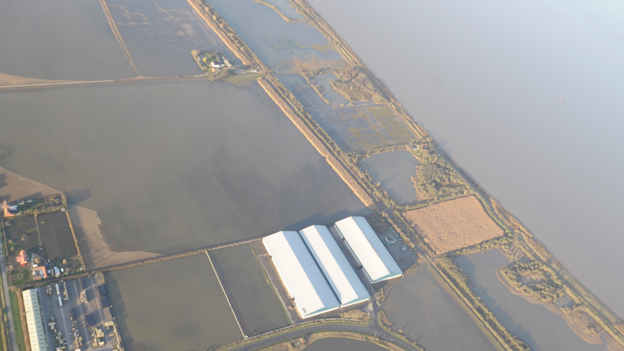
    The project team worked hard to develop the project appraisal and completed the Outline Business Case in January. This business case is being revised based on new information and construction is now likely to begin in 2027. However, the economic business case for the project is likely to remain very robust as it reduces flood risk to around 1300 properties.

    Both the project Steering Group and Resilience Advisory Group are being kept informed and North Lincolnshire Council will be approached for a contribution towards developing the Full Business Case. The project team continues to explore options to reduce costs.

    The project team worked hard to develop the project appraisal and completed the Outline Business Case in January. This business case is being revised based on new information and construction is now likely to begin in 2027. However, the economic business case for the project is likely to remain very robust as it reduces flood risk to around 1300 properties.

    Both the project Steering Group and Resilience Advisory Group are being kept informed and North Lincolnshire Council will be approached for a contribution towards developing the Full Business Case. The project team continues to explore options to reduce costs.


  • Stallingborough Phase 3 Sea Defence Improvements - 3rd stage of construction activities to commence

    Over the winter months, works were paused to protect the nearby sensitive habitats within the estuary. The project team have continued to work with the consultants and the contractors to refine and coordinate all the activities involved in increasing resilience to the river outfalls. This has included further modelling to determine the best arrangement for Oldfleet Drain overflow system, and other required water control structures. The Marine Licence to desilt the foreshore has been granted by the Marine Management Organisation (MMO).

    Much work has also been undertaken to determine the best way to access New Cut Drain outfall, given the

    Over the winter months, works were paused to protect the nearby sensitive habitats within the estuary. The project team have continued to work with the consultants and the contractors to refine and coordinate all the activities involved in increasing resilience to the river outfalls. This has included further modelling to determine the best arrangement for Oldfleet Drain overflow system, and other required water control structures. The Marine Licence to desilt the foreshore has been granted by the Marine Management Organisation (MMO).

    Much work has also been undertaken to determine the best way to access New Cut Drain outfall, given the additional challenges of contaminated ground and the major sewers crossing the existing access point. Now that the necessary agreements, consents and planning elements are in place, work is being carried out via a staged approach to construct the access and enable inspections to take place before refurbishment begins later this year.

    Minor rock armour enhancements have been completed in four locations along the revetment and environmental enhancement opportunities continue to be explored.


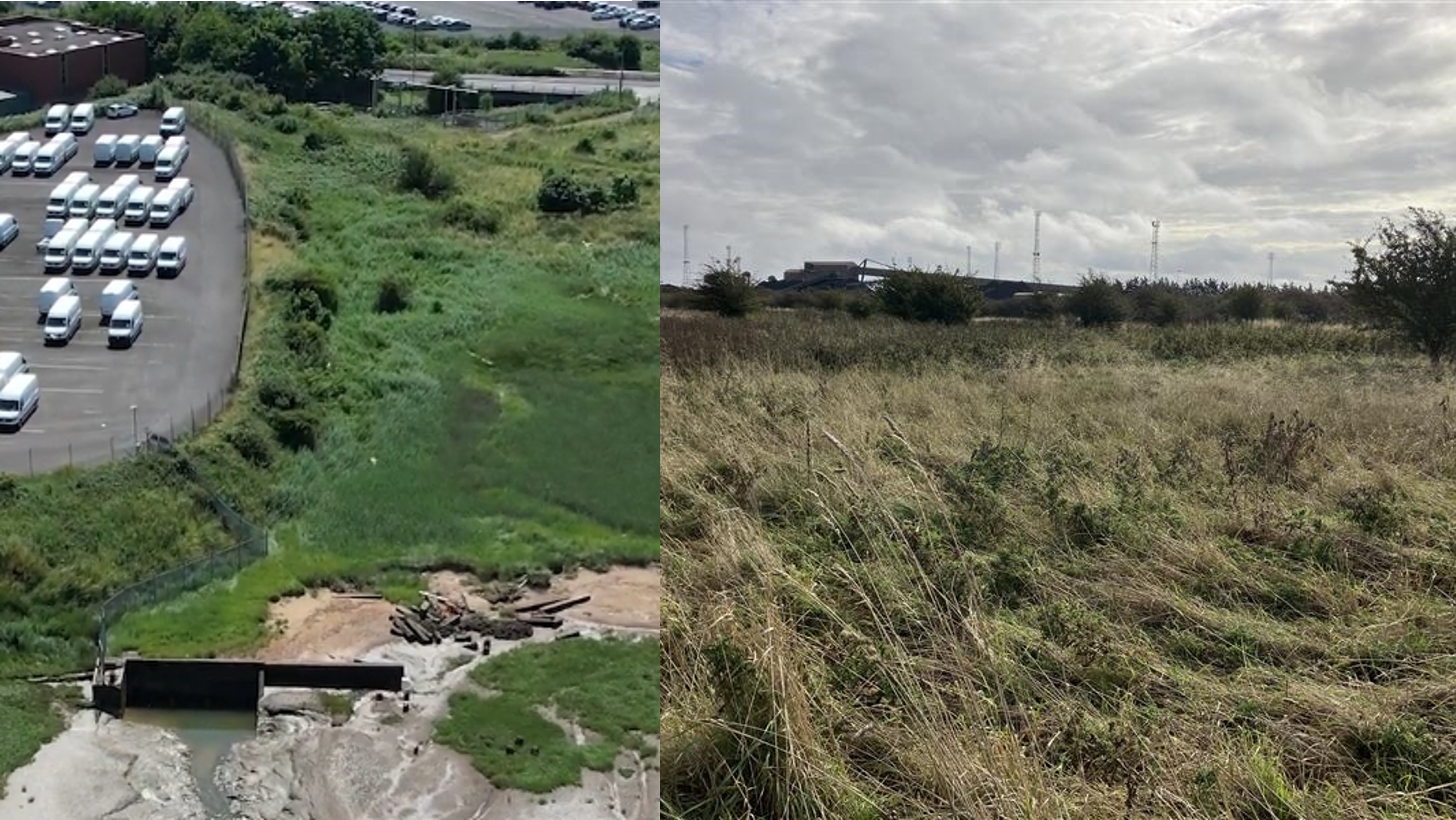
    New Cut Drain outfall (left) and EA's Rosper Road Land, near Port of Immingham (right)


Page last updated: 09 Jul 2026, 01:34 PM