Articles
-
Humber 2100+ - Shaping governance & future adaptation
A partnership working group on governance took place in April, and a second took place in June, with a focus on defining actions for all partners to take forward and developing a common understanding of potential governance models. Work on the strategic approach to asset management is also continuing to progress. The project team have also published a stakeholder facing publication on gov.uk. This summarises the evidence from the ‘Understand Risk’ phase of work.
The Humber Adaptation Pathways project design phase is continuing with activity for the coming months focused on developing the method for pathway refinement. Two workshops areContinue reading
A partnership working group on governance took place in April, and a second took place in June, with a focus on defining actions for all partners to take forward and developing a common understanding of potential governance models. Work on the strategic approach to asset management is also continuing to progress. The project team have also published a stakeholder facing publication on gov.uk. This summarises the evidence from the ‘Understand Risk’ phase of work.
The Humber Adaptation Pathways project design phase is continuing with activity for the coming months focused on developing the method for pathway refinement. Two workshops are also being held through the summer/early autumn. The intention is that work will support partner understanding of the implications of the ‘Understanding Risk’ evidence and allow them to participate in pathway development in the future, as well as shaping elements of the pathway design process.
In February, the Humber 2100+ team and partners participated in a visit from the Climate Change Committee. The team were able to share work done so far on the Humber to support adaptation and also set out future challenges and opportunities.
Climate Change Committee visit Stallingborough Understanding Risk now live on GOV.UK!
Our ‘Understanding Risk’ publication has now been published on Gov.uk. It presents the Humber 2100+ evidence base in an accessible, public-facing format, helping readers understand tidal flood risk around the Humber Estuary. Visit the link below or scan the QR code to find out more!
https://www.gov.uk/government/publications/humber-2100-understanding-tidal-risk

-
Middle Humber - July update
Work on Package 5 (Saltmarshe to Yokefleet) will be prioritised following changes in funding and because it has the highest strategic importance. It is currently being scoped, with contracts being finalised with delivery partners Arup and BAM to develop the Outline Business Case.
-
Dutch River - Embankment works gather pace
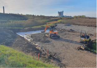
Works have resumed on site following the winter closedown, with embankment improvements progressing well at the downstream end of the Dutch River near Goole. Site offices at the Rawcliffe Bridge compound are now fully in place, and access works (Trackmats) are being installed to support work planned along the upstream embankment this year.
Engagement has continued with those directly affected by the works including local residents and businesses, Internal Drainage Boards (IDB), Canal & River Trust (CRT), Associated British Ports (ABP), and Network Rail. Discussions with East Riding Council on the Greenway improvements have restarted, and we are coordinating withContinue reading
Works have resumed on site following the winter closedown, with embankment improvements progressing well at the downstream end of the Dutch River near Goole. Site offices at the Rawcliffe Bridge compound are now fully in place, and access works (Trackmats) are being installed to support work planned along the upstream embankment this year.
Engagement has continued with those directly affected by the works including local residents and businesses, Internal Drainage Boards (IDB), Canal & River Trust (CRT), Associated British Ports (ABP), and Network Rail. Discussions with East Riding Council on the Greenway improvements have restarted, and we are coordinating with events marking Goole’s bicentenary this year, including EA attendance at a celebratory flotilla planned for July.
-
Barton to New Holland - Improving flood resilience
The detailed design is being advanced at pace by the Arup design team in collaboration with Environment Agency and Jacksons’ team members. The scheme is being designed in sections over the 10km frontage, with the flood walls and embankment improvements nearing completion.
Ground investigation reports are complete, and the programme of ecological surveys has continued. Both these important aspects are shaping the detailed design and temporary works design.
The project team has been able to consider a more ambitious plan for the adaptation measures and improvements to the embankments along Barrow Haven. This is ongoing with several options being exploredContinue reading
The detailed design is being advanced at pace by the Arup design team in collaboration with Environment Agency and Jacksons’ team members. The scheme is being designed in sections over the 10km frontage, with the flood walls and embankment improvements nearing completion.
Ground investigation reports are complete, and the programme of ecological surveys has continued. Both these important aspects are shaping the detailed design and temporary works design.
The project team has been able to consider a more ambitious plan for the adaptation measures and improvements to the embankments along Barrow Haven. This is ongoing with several options being explored, but the team understand the additional complexity and time required to identify such a workable solution. The project team have also secured framework contractors to advance delivery through 2026/27.
Work with North Lincolnshire Council (NLC) around property flood resilience (PFR) and asset resilience measures in the area has continued.
Further ongoing engagement with the community through the Resilience Advisory Group, project website updates and local news sheet articles, complemented the project teams support of the ‘Lincolnshire flood risk and wellbeing roadshow’ in Barton on 12th March. Further consultation with the communities and stakeholders about the proposals is envisaged to be undertaken in Autumn 2026.
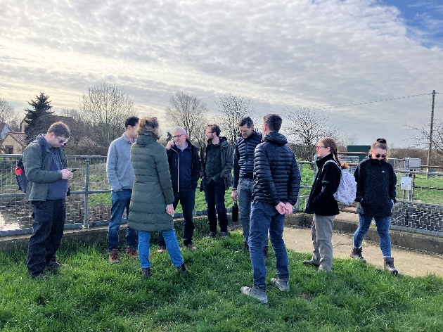
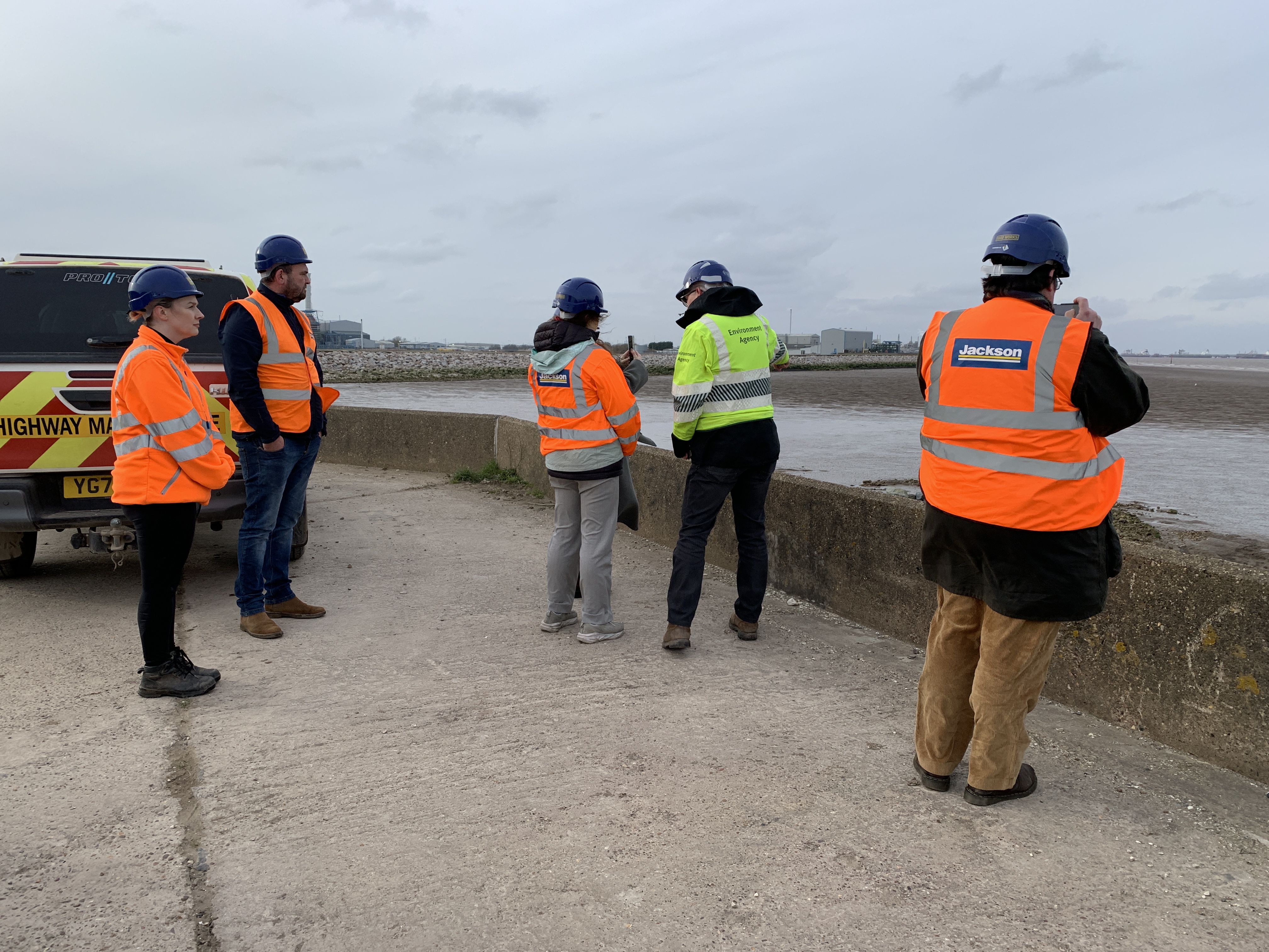
Collaborative on-site discussion
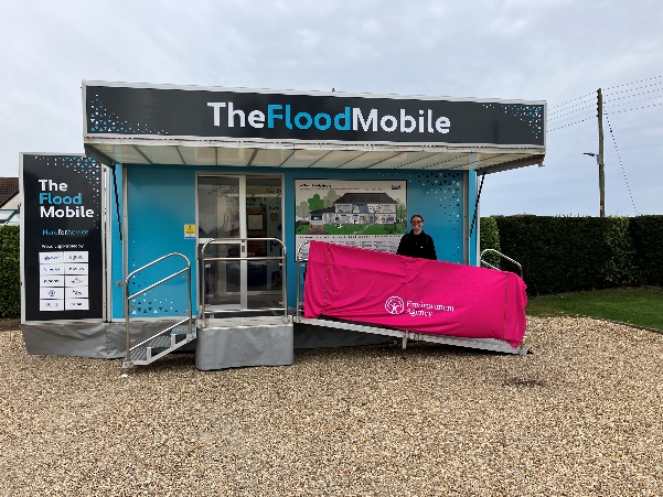
Flood mobile at Barrow Haven -
Stallingborough Phase 3 Sea Defence Improvements: Progress Update
The project team, with support of the Midland Hub PPD Programme Team, are looking to complete on-site works by October 2026.
Securing this and the necessary Marine Licence in January, has allowed the team to plan the required outfall improvement work activities at New Cut Drain over the 2026 working season. This includes desilting the foreshore channel and culvert repairs, installing a new flap valve and building chambers, to allow safe future maintenance access.
The new Oldfleet Drain overflow structure is now largely constructed and reinstated, with both the penstock and tiling weir awaiting installation. The slip liner has beenContinue reading
The project team, with support of the Midland Hub PPD Programme Team, are looking to complete on-site works by October 2026.
Securing this and the necessary Marine Licence in January, has allowed the team to plan the required outfall improvement work activities at New Cut Drain over the 2026 working season. This includes desilting the foreshore channel and culvert repairs, installing a new flap valve and building chambers, to allow safe future maintenance access.
The new Oldfleet Drain overflow structure is now largely constructed and reinstated, with both the penstock and tiling weir awaiting installation. The slip liner has been installed into the existing outfall culvert during the recent period of low flow.
New overflow structure
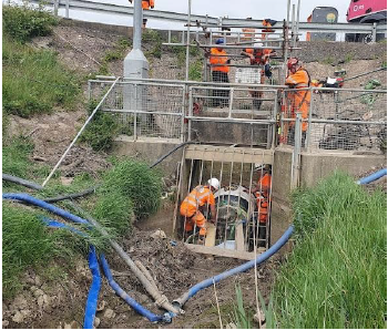
Slip liner installed through outflowThe project team have explored options to re-use the spare rock to strengthen other defences in the area before the existing compound area is vacated in Autumn 2026.
A compensatory fish habitat along the upper reaches of the River Freshney has been planned for installation over summer 2026, in collaboration with the EA’s local Fisheries team.
Landscape reinstatement work, particularly around New Cut Drain/Pyewipe area, has been designed and is expected to be installed through Autumn 2026.
-
Working in partnership - Barton Shine event!
Lincolnshire Flood Resilience Roadshows are taking place across greater Lincolnshire this year to help communities prepare for, respond to and recover from flooding. These free events offer valuable advice alongside practical and emotional tools for recovery from a range of bodies, including emergency services, local organisations and wellbeing partners. There are also demonstrations and workshops for families to get involved with.
Delivered in partnership between Lincolnshire County Council and SHINE, the Environment Agency's Humber team joined other organisations in Barton on 12th March. We joined the Lincolnshire project team to provide updates to the community about the Humber 2100+ projectContinue reading
Lincolnshire Flood Resilience Roadshows are taking place across greater Lincolnshire this year to help communities prepare for, respond to and recover from flooding. These free events offer valuable advice alongside practical and emotional tools for recovery from a range of bodies, including emergency services, local organisations and wellbeing partners. There are also demonstrations and workshops for families to get involved with.
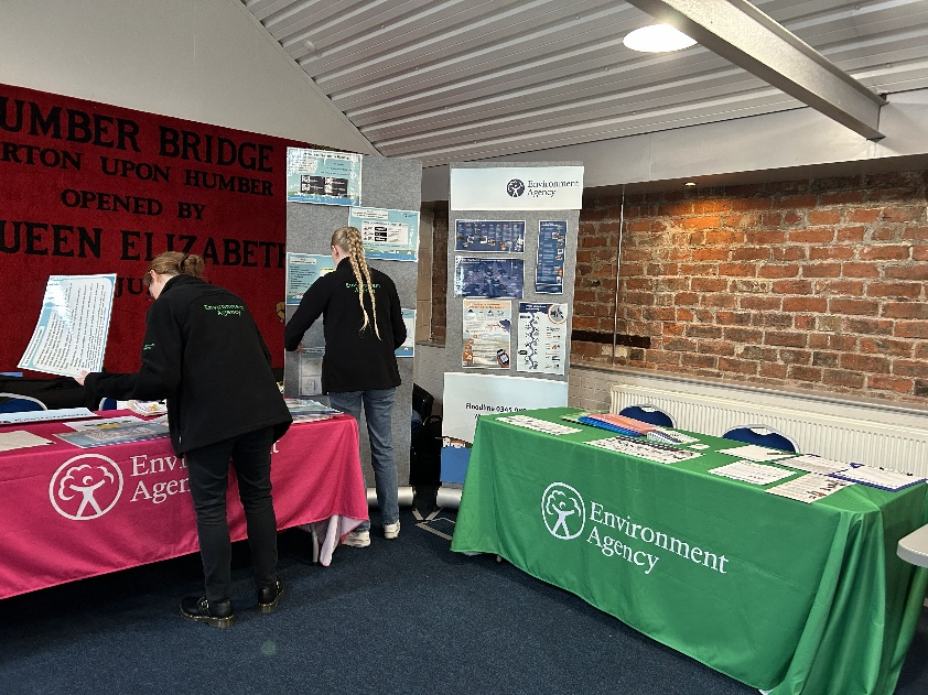
Delivered in partnership between Lincolnshire County Council and SHINE, the Environment Agency's Humber team joined other organisations in Barton on 12th March. We joined the Lincolnshire project team to provide updates to the community about the Humber 2100+ project and the Barton to New Holland Tidal Alleviation Scheme and to encourage people to sign up for flood alerts and flood warnings in their area.
Setting up the Environment Agency stall with colleagues from Lincs and Northants area teams -
The Outstrays - June 2026 Update
Update on Skeffling and Winestead Pumping Stations
The pumps at the new Skeffling pumping station were tested in December and responsibility for their operation is due to be handed over to the Environment Agency in summer 2026.
We have reprogrammed the demolition of the old Skeffling pumping station due to nesting birds on site. It is now due to be demolished and site works completed autumn 2026.
Once this work is completed, the compound off Long Lane will be removed. Part of the existing tarmacked site compound will then be converted into a public car park, large enough to holdContinue reading
Update on Skeffling and Winestead Pumping Stations
The pumps at the new Skeffling pumping station were tested in December and responsibility for their operation is due to be handed over to the Environment Agency in summer 2026.
We have reprogrammed the demolition of the old Skeffling pumping station due to nesting birds on site. It is now due to be demolished and site works completed autumn 2026.
Once this work is completed, the compound off Long Lane will be removed. Part of the existing tarmacked site compound will then be converted into a public car park, large enough to hold 20 cars. In the autumn this year, a plot next to the car park will be planted with seedlings of deciduous trees, including maple, apple, cherry and oak and surrounded by a hedgerow of hawthorn, blackthorn, holly and guelder rose. Deer-proof fencing will be used around this to protect the young seedlings.
JBA Bentley staff will also install the two remaining interpretation panels for the site. One will be placed in the new car park and the last one on the embankment, close to the old Skeffling pumping station, offering a map of the site to guide visitors around it.
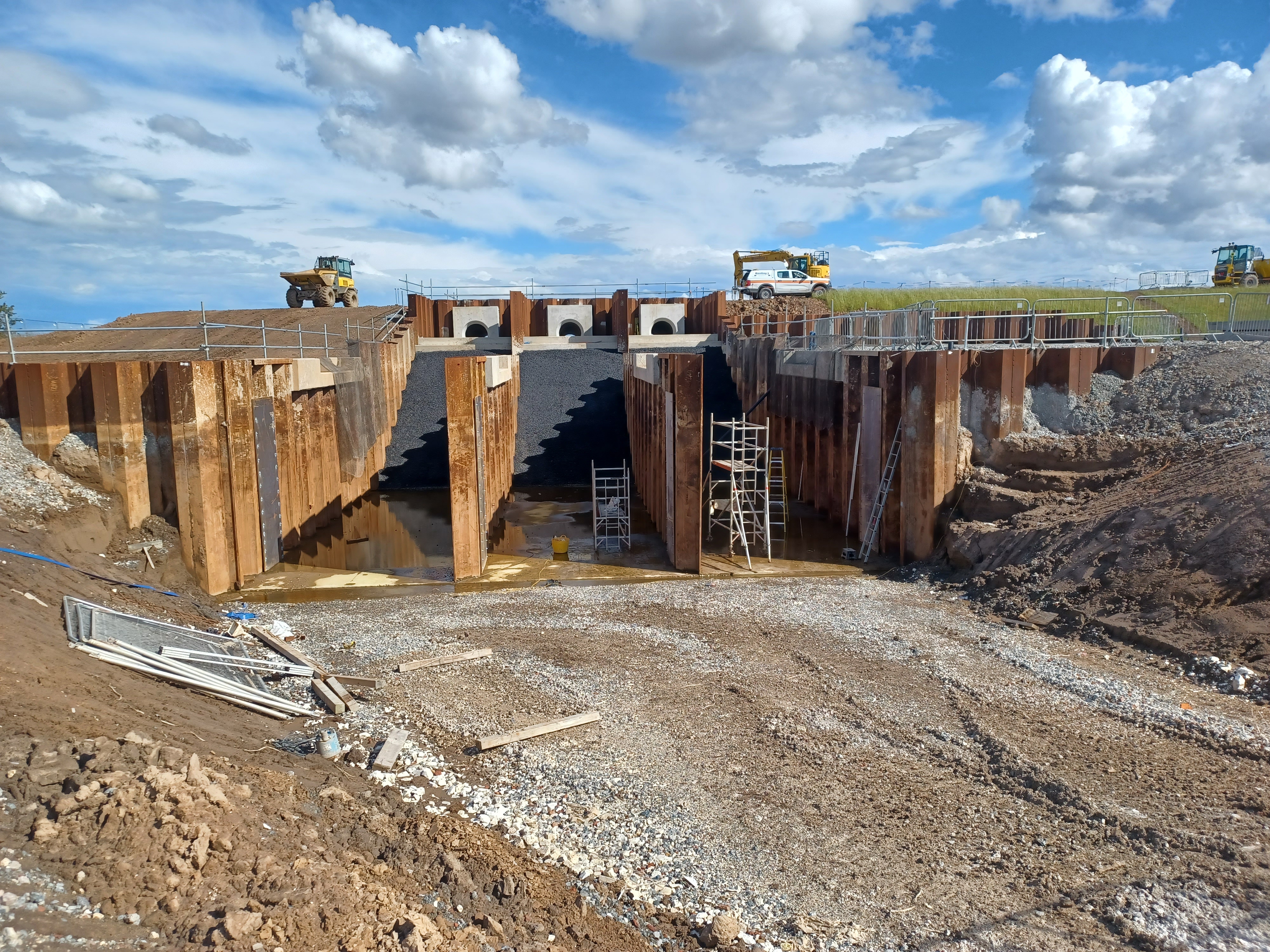
Figure 1: A picture showing current progress with the construction of the Winestead Pumping StationWork on Winestead pumping station restarted in early March, with JBA Bentley staff returning to site at the end of February to prepare for the new construction season. The new pumping station is currently forecast to be complete early 2027, with demolition of the existing Winestead pumping station completed by winter 2027.
Access on The Outstrays: Paths and Bridleways
At both pumping stations, some access restrictions will still be required this year to ensure visitor safety. These are described below.
a) From the Eastern (Skeffling) end of the scheme
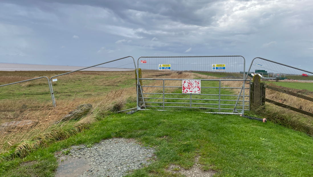
In the last newsletter we mentioned our intention to remove the existing diversion onto Long Lane and open the bridleway along the embankment, once work on the new Skeffling pumping station was completed. Currently, there is a gate across the embankment top, and walkers are directed to follow a diversion to avoid passing the new pumping station. However, this change has been delayed whilst we finalise a design that will meet required bridleway access standards whilst limiting vehicle access on top of the embankment.
We have met with East Riding of Yorkshire Council’s (ERYC) Public Right of Way officer to finalise plans and intend to open up the route along the embankment after the old pumping station is demolished. This route will not be suitable for disabled visitors. Wheelchair users and other disabled visitors should follow the route to the bridleway from the new Skeffling car park.
Figure 2: A picture showing the gate across the embankment at Skeffling pumping station. This will be in place until after the pumping station is demolishedThe demolition of the old Skeffling pumping station should not affect public access along this section of the bridleway. Our contractors will carefully manage the site to maintain access and meet public safety standards whilst the work is carried out. The car park on the landward (dry) side of the embankment will remain open. However, visitors will no longer be able to park their cars on top of the embankment whilst the demolition is carried out.
b) From the Western (Outstrays) end
Whilst work on the new Winestead pumping station continues during 2026, we will need to divert a section of the King Charles III England Coast Path (ECP). We have worked with ERYC officers and our contractors to develop a route for this diversion.
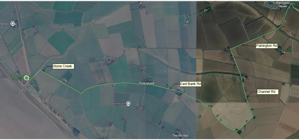
We have agreed with ERYC that the ECP will be temporarily diverted as shown by the green line in the map below. The diversion will come into effect on the 29 June 2026 and will remain in place until winter 2027.
You can find the current version of the route for this section of the coast path at the ECP interactive website; King Charles III England Coast Path - North East Map and Information - National Trails. Just click on the map for the trail running from the Humber Bridge to Easington and enlarge the section from Sunk Island to Skeffling to see the route (also see map below). This is the approved route around the managed realignment site but will be updated in due course to facilitate the diversion shown in the map below.
Figure 3: Map showing the temporary diversion of the King Charles lll England Coast Path (green line)Please be aware that if you are using an old map to navigate around the site, the paths shown will no longer be accurate. This includes former rights of way across the West Two wet grassland area which no longer exist. Crossing this protected area disturbs wildlife and is not permitted. The same applies to the old flood embankment, which is no longer a designated route. It is also not possible for visitors to cross the intertidal area south of Welwick, to reach Welwick Saltmarsh.
Additional signage will be installed to help visitors navigate around the site and keep to public paths. If you spot somewhere where you think there are gaps in the signage and some extra signs would help show the right route to take, please email welwick.skeffling@environment-agency.gov.uk
The track to the existing Outstrays pumping station will need to be temporarily closed to the public. This is because the excavation of inlet and outlet channels to and from the new pumping station will permanently cut cross this path to connect to Winestead Drain. This work is expected to take place either summer 2026 or spring 2027. We know that the track is a popular route for walkers and so hope to reopen it in autumn 2027, once the existing pumping station is demolished. We’ll provide more information about any restrictions in future newsletters.
Please follow all on-site instructions and do not climb over gates and fences where signs indicate that there is no public access. These restrictions are for public safety and to protect wildlife in the new intertidal and wet grassland habitats.
Disturbing birds is an offence under the Wildlife and Countryside Act 1981. If you see anyone ignoring instructions to stay out of fenced-off areas, or witness antisocial behaviour such as off-road motorcycling, please report this to the police by visiting www.humberside.police.uk or calling 101.
Connecting bridleways
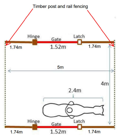
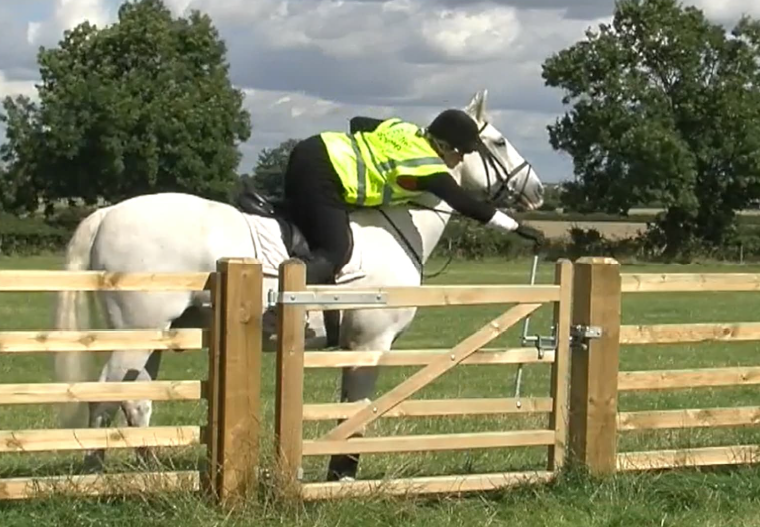
The scheme will have a new bridleway through Haverfield, connecting two existing ‘dead-end’ bridleways at each end of the site: one off Sheep Trod Lane and the other from Mulberry Lane. This will allow horse riders to travel from Skeffling to Patrington Haven without having to use the main road. We have been working with ERYC officers to agree the details of this route and expect it to be operational by winter 2026. Vegetation clearance was carried out in early 2026, before the bird nesting season, to link paths from the entrance off Mulberry Lane to the path along the drain, with further enabling works still to be delivered. The horse gate will be installed Summer 2026 and additional fencing provided. The horse gate layout is as the sketch and operated as per the photo below.

Figure 4: A diagram showing the design of the horse gate (left) alongside a photo of a horse gate being used (right)Managing and monitoring The Outstrays
Whilst we continue to develop plans for the future, long-term, arrangements for the site, the Environment Agency will carry on with the direct management activities required to enable public access and ensure the sites wider habitat requirements and objectives are met.
JBA Bentley’s ecology team has begun a programme of environmental monitoring across the intertidal and wet grassland areas.
This initial monitoring is focused on establishing a clear picture of how the site is developing following the breach. This includes tracking changes in habitats and vegetation, recording how plant communities are establishing, and observing how wildlife uses the site. We are also monitoring physical conditions such as water levels, which play a key role in shaping these new environments.
This data will help us build a picture of how the site is evolving and provide a baseline against which future changes can be measured. Over time, this will allow us to assess how well the site is functioning as a whole and whether it is meeting its environmental objectives.
Contact Us
Environment Agency
For enquiries, please email: Welwick.Skeffling@environment-agency.gov.uk or phone our National Customer Contact Centre on 03708 506506 and ask for Anthony Kidd, Project Manager.
JBA Bentley
For enquiries about the work on site, contact Paul Craig, the site manager on 07837 454048.
-
Stallingborough February 2026 Update
Throughout the third year of construction in 2025 both the access tracks across the foreshore to Oldfleet Drain and New Cut Drain outfalls have been completed. This includes the complex additional water main crossings at the southern end near Pyewipe.
The design of the Oldfleet Drain overflow system is now complete and approved, allowing construction works to commence in December 2025.
The additional construction works to clear the New Cut Drain outfall in a safe manner, have been deferred to spring/summer 2026. The project team have identified an alternative and more efficient method to desilt the outfall culvert, but theContinue reading
Throughout the third year of construction in 2025 both the access tracks across the foreshore to Oldfleet Drain and New Cut Drain outfalls have been completed. This includes the complex additional water main crossings at the southern end near Pyewipe.
The design of the Oldfleet Drain overflow system is now complete and approved, allowing construction works to commence in December 2025.
The additional construction works to clear the New Cut Drain outfall in a safe manner, have been deferred to spring/summer 2026. The project team have identified an alternative and more efficient method to desilt the outfall culvert, but the amended Marine Licence from the MMO is still awaiting approval (now expected by Spring 2026).
The project team have worked with the Area Fisheries Biodiversity and Geomorphology (FBG) team to explore some fish and eel compensatory habitat for impacts of the outfall improvements. This is expected to be undertaken along the upper reaches of the River Freshney, throughout 2026.
Landscape reinstatement work, particularly around New Cut Drain/ Pyewipe area has been designed, and the works are expected to be completed by March 2026. Environmental enhancements are being finalised, with delivery under a separate 5-year landscape maintenance contract from Autumn 2026.
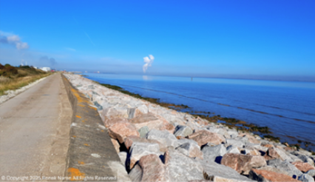
Granite rock armour to 3km of the coastal defence
Oldfleet Drain - new access track to outfall
Oldfleet Drain overflow enabling works underway
Anglian Water sewer mains crossing at Pyewipe -
Barton to New Holland February 2026 update
The first stage business case for the project was approved in August 2025, for an estimated cost of £39M. Since then, the project team and consultant Arup have agreed the scope and programme to develop the Final Business Case (FBC), including detailed design, necessary evidence, consents and approvals.
We are also continuing to employ our framework contractor Jackson Civil Engineering to help advise on construction methods, costs and enabling works. As such, the second phase of the ground investigation has now been completed, with associated reports due shortly.
The project team are continuing to consider the scope of asset resilienceContinue reading
The first stage business case for the project was approved in August 2025, for an estimated cost of £39M. Since then, the project team and consultant Arup have agreed the scope and programme to develop the Final Business Case (FBC), including detailed design, necessary evidence, consents and approvals.
We are also continuing to employ our framework contractor Jackson Civil Engineering to help advise on construction methods, costs and enabling works. As such, the second phase of the ground investigation has now been completed, with associated reports due shortly.
The project team are continuing to consider the scope of asset resilience and repairs that could be incorporated into the scheme, e.g. at Barrow Haven and the team have had very productive meetings with Councillors from North Lincolnshire Council.
The ecological surveys have continued, with both bat and badger habitat surveys now progressing. Involved landowners have been informed. The project team are actively trying to spot any opportunities to significantly reduce the amount of funding contributions required. Construction is expected to take around 2 years, with the ambition to commence late 2027/28.
December 2013 tidal surge - New Holland looking westwards
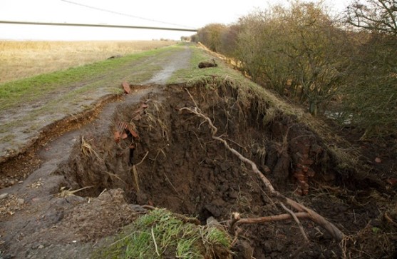
December 2013 tidal surge - defence embankment damage -
Dutch River - Engagement ahead of construction
Works are progressing steadily following mobilisation and site set-up at the end of September despite the recent wet weather and high spring tides causing some challenges. The focus is currently around the downstream areas near Goole.
Extensive engagement has been ongoing ahead of and alongside mobilisation and construction start, including:
- Discussions with landowners including Internal Drainage Boards (IDBs), Canal & Rivers Trust (CRT) and Associated British Ports (ABP) as well as other stakeholders, such as Network Rail, Exolum, Northern Gas Networks and Yorkshire Water, concerning the works and associated access, agreements, permits and permissions for the delivery phase.
- Discussions withContinue reading
Works are progressing steadily following mobilisation and site set-up at the end of September despite the recent wet weather and high spring tides causing some challenges. The focus is currently around the downstream areas near Goole.
Extensive engagement has been ongoing ahead of and alongside mobilisation and construction start, including:
- Discussions with landowners including Internal Drainage Boards (IDBs), Canal & Rivers Trust (CRT) and Associated British Ports (ABP) as well as other stakeholders, such as Network Rail, Exolum, Northern Gas Networks and Yorkshire Water, concerning the works and associated access, agreements, permits and permissions for the delivery phase.
- Discussions with local residents and businesses around potential construction impacts and planned mitigation
- Briefings issued to local MP (David Davis); ERYC; Goole Town Council and local Parish Councils
- Press Release issued to coincide with Flood Action Week, which has received strong local coverage
The work is expected to continue over two earthworks seasons, with completion planned for summer 2027.