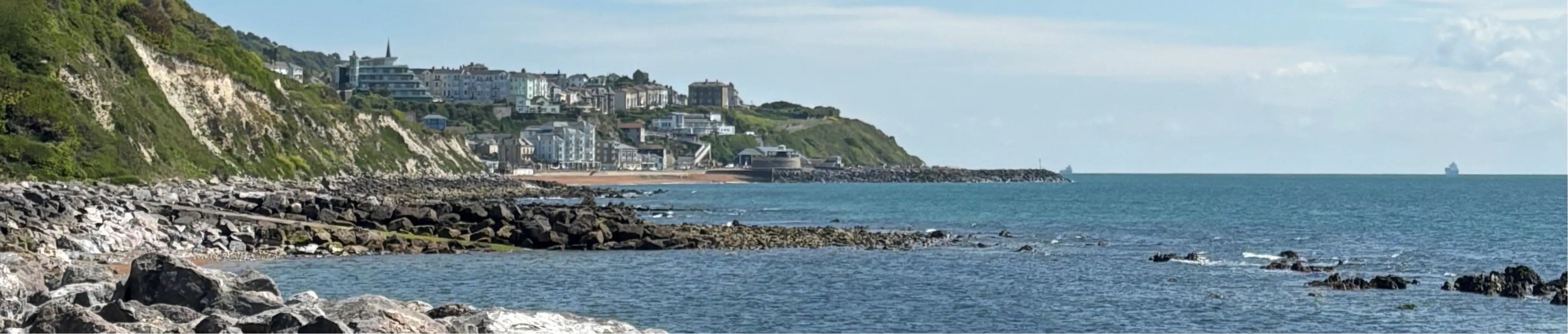
Ventnor Coastal Defence Scheme
The Environment Agency and the Isle of Wight Council are working in partnership to refurbish coastal defences for Ventnor. This scheme will help protect businesses and infrastructure from erosion over the next 60 years.
Sign up to our Newsletter
Want to receive updates on this project or other coastal defence projects across the Isle of Wight? Just email us at IOW_FDschemes@environment-agency.gov.uk and let us know which projects you're interested in, and we'll add you to our mailing list.
-
Ground investigation survey work starting in Ventnor

From Monday 13 July 2026 (for up to three weeks)
We are carrying out a range of survey works along Ventnor seafront and surrounding areas to help us better understand the condition of the existing coastal defences and the services and infrastructure located beneath and within them.
The information gathered will help inform more detailed ground investigations planned for later this year as we continue to develop plans for Ventnor's coastal future.
The work will involve specialist handheld equipment and scanners that allow us to investigate beneath the ground surface without digging or causing disruption.
What you might seeDuring this period, you may notice survey teams working along the seafront between Steephill Hill Cove and Monks Bay carrying out activities such as:
Surveying beneath the ground surface using specialist scanning equipment
Inspecting sections of the coastal defences
Cleaning small areas of the sea wall to allow detailed condition surveys to take place
Accessing existing inspection chambers and manholes where required
Welfare & storage facilities in a secure compound that will temporarily be established at Eastern Esplanade (next to the skatepark)
 Compound location at Eastern Esplanade
Temporary parking restrictions
To support the survey work, 27 parking spaces at the Eastern Esplanade Long Stay Car Park, nearest the skatepark, will be temporarily unavailable.
The affected spaces will be closed:all day on Thursday 16 July
- until 1pm on Friday 17 July
Wheelers Bay
A small area in Wheelers Bay will also need to be accessed for a short period as part of the surveys. This will require the temporary relocation of a small number of dinghies. Affected users have been contacted directly and arrangements made to minimise any inconvenience.
Keeping disruption to a minimum
There will be:No planned digging
No planned road closures
Very little noise
No restrictions to access for residents, businesses or visitors
Aside from seeing our welfare facilities in a secure compound that will temporarily be established at Eastern Esplanade, or survey teams working on site most people are unlikely to notice any significant impact from the works.
Please note that separate maintenance works are also currently taking place on Eastern Esplanade, near the skatepark. These works involve repairs to the seawall and are being carried out by OPEX on behalf of the Isle of Wight Council.
If you have any questions about the survey work, please contact the project team at IOW_FDschemes@environment-agency.gov.uk
-
Read Now: Landscape Vision & Opportunities Plan
What is the Landscape Vision & Opportunities Plan?
The Landscape Vision & Opportunities Plan has been created using feedback, ideas and local knowledge shared directly by the Ventnor community. Over the course of the project so far, residents, businesses and stakeholders have told us what matters to them about the seafront and how they would like it to evolve. This plan brings that insight together into a set of ideas that explore how the area could look and function in the future. Not all of the ideas can be funded through the Coastal Defence Scheme. Some opportunities could be deliveredContinue reading


Contact/enquiries

Documents
-
 Landscape Visions and Opportunities Plan.pdf (39.6 MB) (pdf)
-
 Ventnor Exhibition Posters
-
Poster 1 - Introduction.pdf (306 KB) (pdf)
-
Poster 2 - The need for coastal defences.pdf (206 KB) (pdf)
-
Poster 3 - Current coastal defences in Ventnor.pdf (292 KB) (pdf)
-
Poster 4 - The plan moving forward.pdf (168 KB) (pdf)
-
Poster 5 - Priority frontages.pdf (526 KB) (pdf)
-
Poster 6 - Challenges.pdf (406 KB) (pdf)
-
Poster 7 - The leading solution.pdf (367 KB) (pdf)
-
Poster 8 - Western Cliffs.pdf (359 KB) (pdf)
-
Poster 9 - Eastern Esplanade.pdf (403 KB) (pdf)
-
Poster 10 - Holiday Villas.pdf (380 KB) (pdf)
-
Poster 11 - Wheelers Bay.pdf (409 KB) (pdf)
-
Poster 12 - Bonchurch Seawall.pdf (376 KB) (pdf)
-
Poster 13 - Promenade improvements.pdf (542 KB) (pdf)
-
Poster 14 - Protecting our cultural heritage.pdf (559 KB) (pdf)
-
Poster 15 - Have your say.pdf (237 KB) (pdf)
-
-
Ventnor Engagment Feedback report.pdf (347 KB) (pdf)


