What's In My Area
St Johns to Pinkhill (Catchment A)
Ten Foot Bridge - Faringdon
We are pleased to announce that the Environment Agency's local field team successfully completed the reconstruction of Ten Foot Bridge on 18 August 2026. The pedestrian crossing between Rushey and Shifford Locks, near Buckland village in Faringdon, has now been fully restored, reconnecting this important route for local communities and visitors.
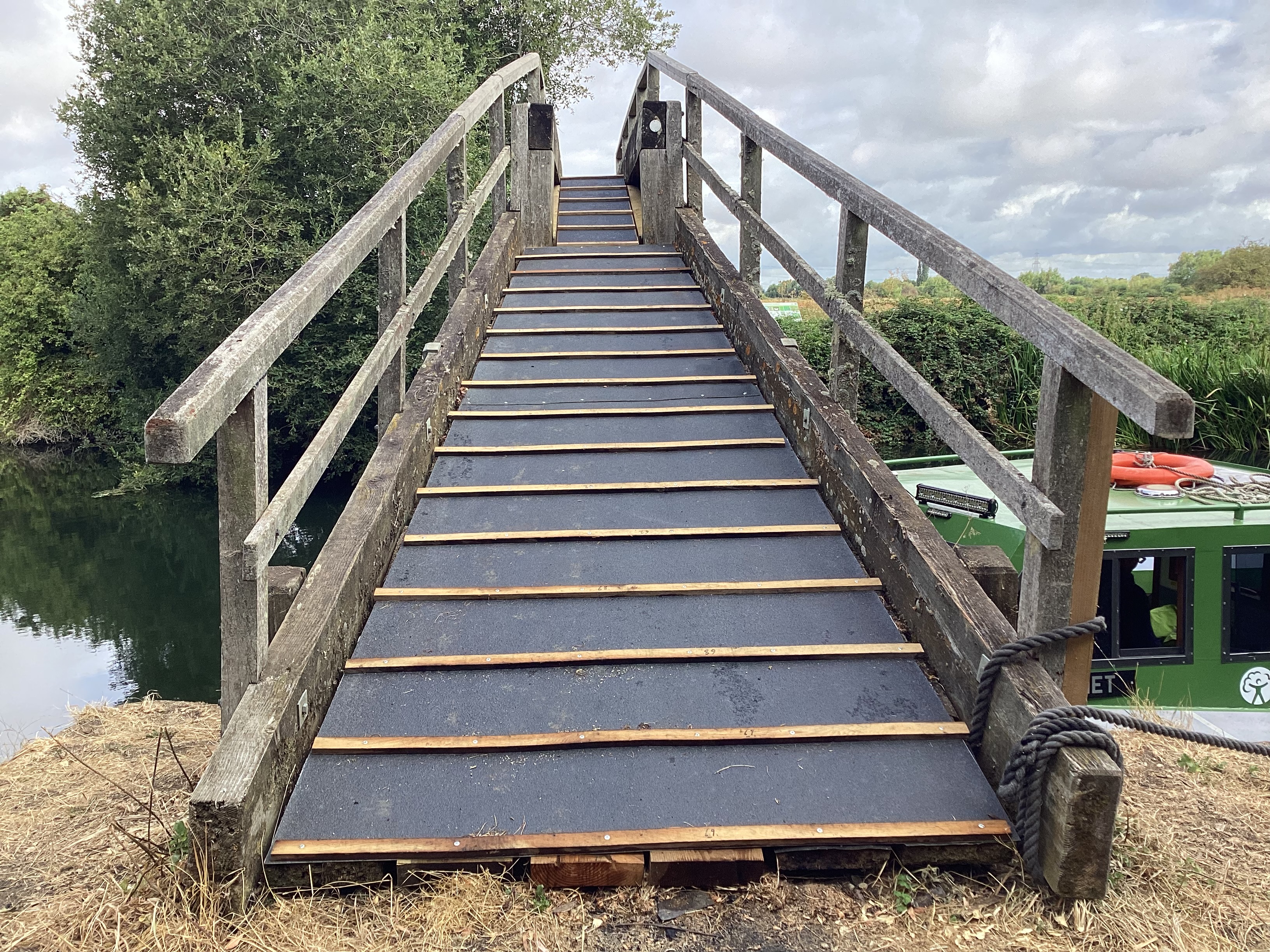 | 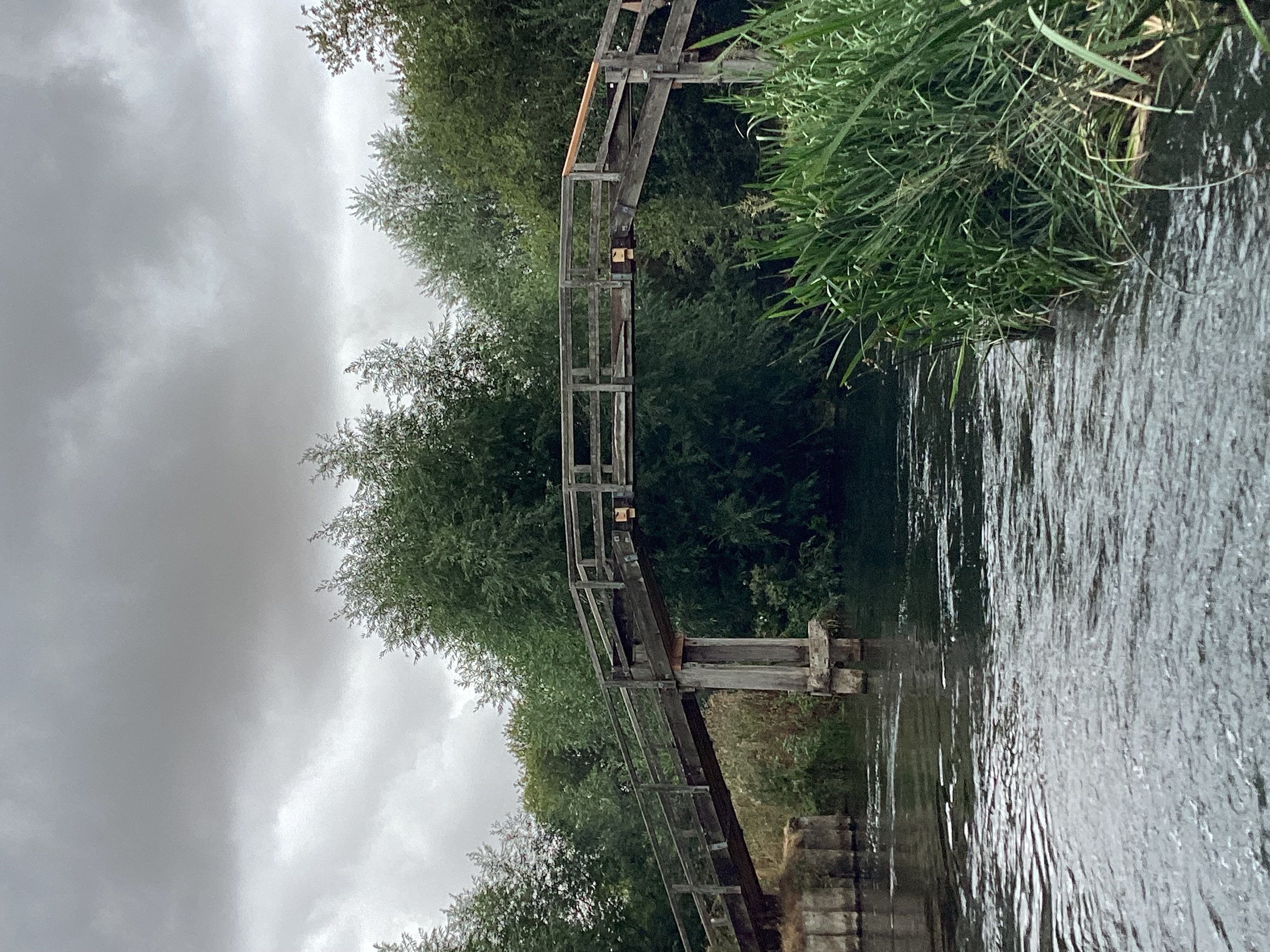 | 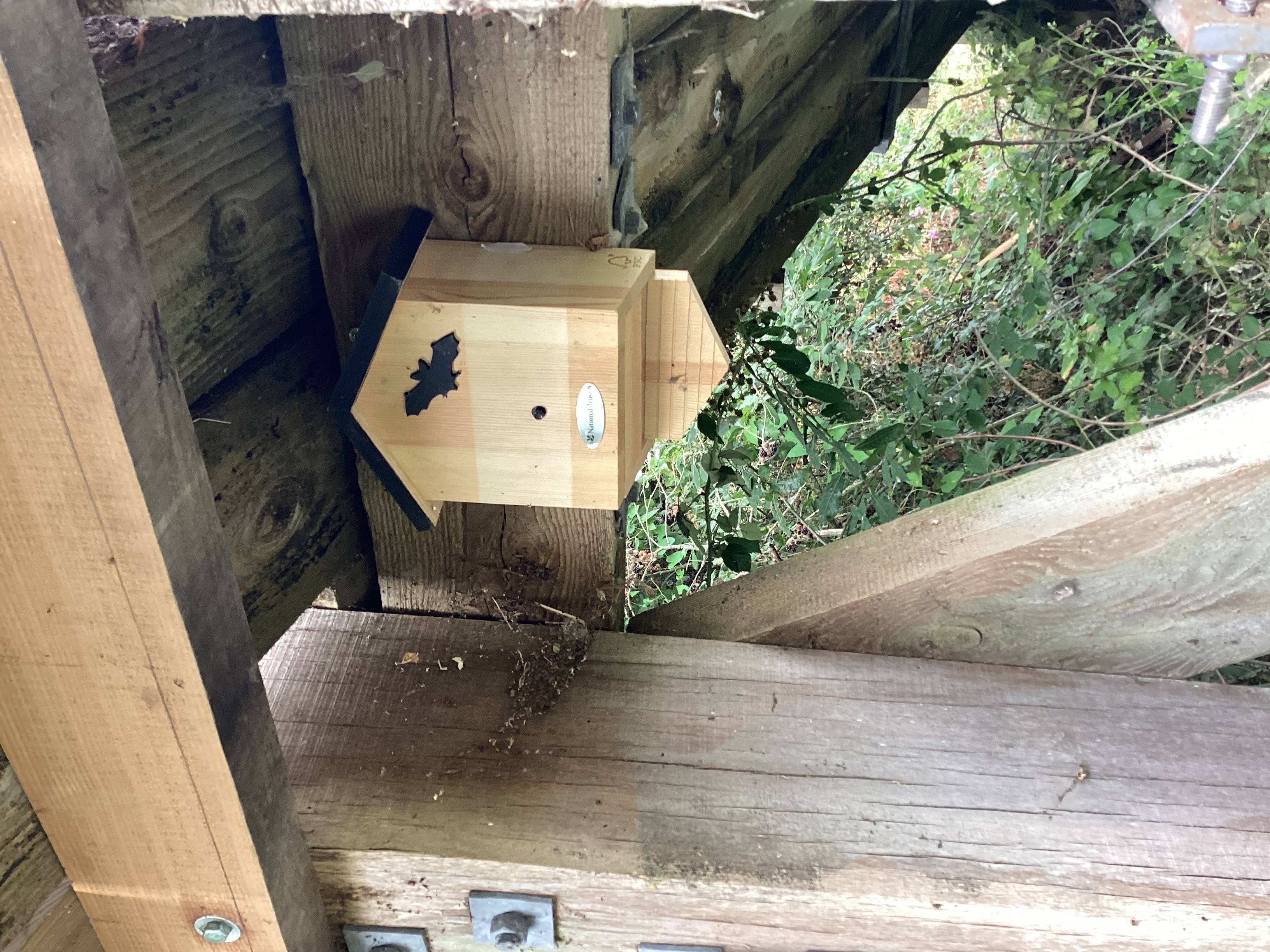 |
Photos of the reconstructed bridge and one of the new bat boxes | ||
Background
Keeping the public safe is one of our highest priorities and therefore following a structural inspection, we regrettably closed the bridge in March 2024 due to numerous structural and safety concerns.
The work is part of a wider programme of competing priorities across the non-tidal Thames associated with our Navigation infrastructure.
Following the initial bridge inspection, a follow-up specialist survey of the bridge was completed to fully understand the structural issues associated with the bridge.
During the work, bat boxes situated on the bridge were inspected and removed under the supervision of an experienced Environment Agency ecologist.
New bat boxes have since been re- installed to support this protected species.
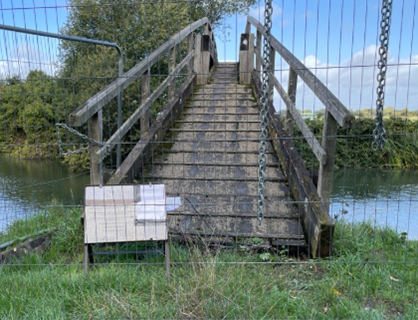 | 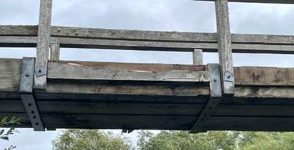 |
The bridge before refurbishment | |
Contact us
If you see damage at this site or any other of our assets, please call our 24-hour Incident Hotline on 0800 80 70 60. More information can be found at https://www.gov.uk/report-environmental-problem(External link)
Please email us at enquiries_thm@environment-agency.gov.uk(External link) however please note that the most up to date information can be found here on this information page.
You can also phone our National Customer Contact Centre on 03708 506 506 (Monday to Friday, 8am to 6pm).
Eynsham to Abingdon (Catchment B)
Abingdon Weir Walkway
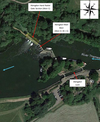
Abingdon Weir Walkway is open to the public
We have been able to re-open the weir walkway in Abingdon.
This is now possible as the flow in the river has reduced enough to enable us to close the small radial gates.
Our staff have inspected the weir structure following the recent closure of the small radial gates and have confirmed there is no sign of further deterioration.
We will continue to monitor the situation to safeguard our staff and members of the public and are grateful to everyone’s patience while the weir walkway has been closed.
Background
Abingdon walkway and weir structure were built in the 1960s.The walkway carries the Thames path from Abingdon lock to the Abingdon Meadows.
The most recent survey of Abingdon walkway revealed that several sections require refurbishment.
We have taken many factors into consideration when making the decision to re-open the walkway including the current low flows and reduced likelihood of debris impacts on our weir. The structural survey and subsequent diver's surveys show that the supporting steel A frames are corroded along the weir walkways, especially on the small radial weir gate section.
The walkway supporting structure continues to need refurbishment in order to achieve its full design strength. It therefore remains at risk from impact damage during high flows.
We appreciate all our customers' patience while we progress this important work and are grateful to everyone for continuing to use the footpath diversion when the weir walkway is temporarily closed
Next steps
We are evaluating the extent of the walkway strengthening work that can be carried out next financial year.
Site security
We have experienced repeated vandalism of our security measures since the walkway was closed to the public. We will be reviewing our site security and will be putting in additional measures to ensure that if we need to close the walkway again, it will remain secure.
In order to keep members of the public safe, the weir walkway will be closed when the river flows are high and the trigger point for closure is reached.
Contact us
If you see damage at this site or any other of our assets, please call our 24 hour Incident Hotline on 0800 80 70 60. More information can be found at https://www.gov.uk/report-environmental-problem(External link)
Please email us at enquiries_thm@environment-agency.gov.uk(External link) however please note that the most up to date information can be found here on this information page.
You can also phone our National Customer Contact Centre on 03708 506 506 (Monday to Friday, 8am to 6pm).
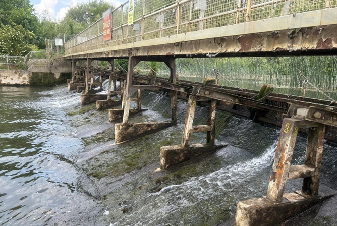
picture of the section of the weir that requires refurbishment
Culham to Whitchurch (Catchment C)
Benson Weir Replacement
Background
The Benson Weir replacement project is part of our ongoing work to refurbish major assets along the non-tidal Thames to improve our Navigation service.
The footpath over Benson Weir unfortunately needed to be closed in November 2022 due to increasing safety concerns resulting from the accelerated weakening of the overall structure. The weir structure has performed well over its operational life but has been affected in recent years by the impact of floating objects against the deteriorated steelwork.
Planning for the new weir
Our project team developed a business case during 2023 to secure the funding to progress the design and construction work. Technical designs for the new weir were completed in January 2024, and construction started in June 2024.
Creating the new weir
This significant project needed to be delivered over a 2-year period due to its scale and complexity. Periods of high flows during the construction work increased the complexity and duration of this project as our contractor used floating pontoons to position all of their cranes and equipment.
We prioritised the replacement of the weir gates to enable our operational staff to be able to continue managing the River Thames flows throughout the project. Our contractor then focused on the creation of a new structure that allows many fish and eel species to pass easily though the weir structure. This fish / eel pass will help to improve the overall biodiversity of the non-tidal Thames and is something that we aim to achieve with every major weir refurbishment.
We have also improved the weir guarding system that reduces the likelihood of objects hitting the new weir during periods of increased river flow.
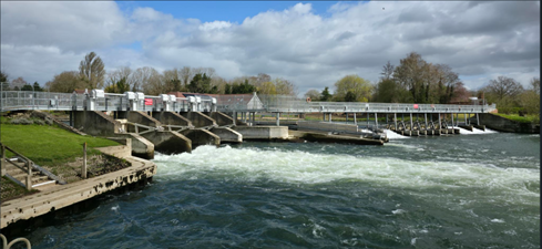
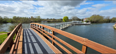
Our contractor has substantially completed the weir replacement works, and the weir walkway re-opens at 9am on 1 April 2026. The improved walkway over the weir has an increased width of 1.5m, compared to the previous 0.9m. This will allow more Thames Path users to walk over the weir more freely and also allows for our operational staff to adjust the weir gates when needed without obstructing walkers.
Photos of the completed Weir
Contact us
Please email enquiries_thm@environment-agency.gov.uk(External link)(External link) if you have any queries regarding this project.
You can also phone our National Customer Contact Centre on 03708 506 506 (Monday to Friday, 8am to 6pm)
River Wide Information
Mapledurham to Marsh (Catchment D)
Marsh Head Horsebridge
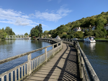
The Head Horsebridge looking downstream towards the Marsh Lock Island. Environment Agency 2022.
Background
Marsh Head Horsebridge is situated near Marsh Lock, Henley-on-Thames, Oxfordshire. It is 1 of 2 footbridges of similar construction in this location. The bridges carry a public right of way from Shiplake, downstream past Marsh Lock, and back to the riverbank near Henley. They are both part of the Thames Path National Trail.
A bridge was first constructed at the site in 1796, and the current bridge was last subject to a major refurbishment in the 1990s.
Keeping the public safe is one of our highest priorities. Following a structural inspection, we regrettably closed Marsh Head Horsebridge in May 2022 due to structural and safety concerns.
Recent Updates
Thank you to everyone who attended our public event on Wednesday 20 May 2026.
You can view the event posters here. (External link)
We recognise that the Marsh Horsebridge is an important recreational asset for the residents of Henley, Shiplake and Harpsden. It is also a valued heritage asset on the River Thames and forms part of one our National Trails. However, the bridge does not provide any operational purpose for the Environment Agency and therefore does not directly receive central government funding for its ongoing maintenance. The full cost of the reconstruction work therefore needs to be met by other sources of funding.
Crowdfunding provides an opportunity for anyone with an interest in the Marsh Horsebridge to contribute and collectively support a solution. This approach reinforces the strong community focus to undertake the repairs. Our crowdfunding information page can be found here: www.projectsfornature.com/marsh-horsebridge(External link) Please register on the page for further updates, and once the Crowdfunding opens for donations, you will be notified. Alongside the Crowdfunding we are looking to secure funding from National Lottery Heritage Fund, local councils, private donors and corporate partners.
The initial design, produced in March 2026, will be used to inform the next stages of design development including material options appraisal, evaluation of costs and help to identify a suitable contractor.
Once our designs have been finalised and we have secured the required level of funding and planning permission for the replacement bridge, we will be able to confirm dates for the reconstruction work.
Marsh Tail Horsebridge
This bridge has recently been surveyed and has been confirmed as being in a reasonable condition. We do, however, need to replace some of the deck boards and carry out other minor repairs to this bridge. A footpath diversion application has been submitted to temporarily close this bridge while we carry out the necessary repairs. We anticipate this work will take place in summer 2026 and expect it to last around 2 to 3 weeks. We will aim to leave the bridge open outside of working hours.
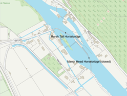
Footpath Diversion
Information can be found here: www.nationaltrail.co.uk/en_GB/short-routes/thames-path-marsh-lock-footbridge-closure-and-diversion/?trail=thames-path (external link)
We are grateful to all our customers and stakeholders for their ongoing patience.
Previous update
Thank you to everyone who attended our public event on Wednesday 20 May. If you have not already done so, please take a few minutes to complete the feedback survey here:
https://forms.office.com/Pages/ResponsePage.aspx?id=UCQKdycCYkyQx044U38RAljB-rKua69Em9t8MjEnHFBURERaRDM1Mko0M1dQVFRUSTQwODA0WFZSRC4u(External link)
You can also view the event posters here.
Contact us
Please note the most up to date information can always be found on this page. However, if you have a specific query please email enquiries_thm@environment-agency.gov.uk(External link)
You can also phone our National Customer Contact Centre on 03708 506 506 (Monday to Friday, 8am to 6pm).
Hambleden to Bray (Catchment E)
Temple Footbridge
Background
Temple footbridge, which crosses the River Thames upstream of Temple lock near Marlow, was created in 1989 partially using community funding. It was constructed from tropical hardwood and had an approximate design life of 30 years.
Keeping the public safe is one of our highest priorities and we (Environment Agency) closed Temple Footbridge on 15 May 2023 due to numerous structural and safety concerns. We know the bridge is important to both local people and visitors using the Thames Path, and we are treating this matter as a priority.
Recent update
We have received the outline designs of potential bridge replacement options and are now in the process of working with our construction partners to assess the likely costs of each option. We're continuing to work with the Thames Path Partnership to explore a sustainable long-term solution for this section of the Thames Path and improve understanding of the available opportunities and constraints.
To find out more about the work completed so far and hear about the latest developments, join us at our public information event on Friday 16 October 2026, from 4pm to 7pm at Marlow Rugby Club. Members of the project team will be available throughout the event, with a Q&A session at 6pm.
Further details will be shared here once they are available.
Photos from the recent survey of the side spans:
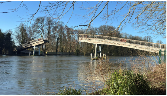
General view the bridge’s side spans looking west
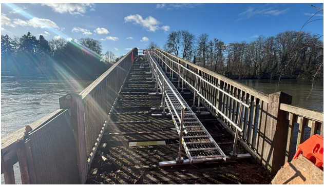
Temporary access installed to enable bridge engineers to inspect the side spans
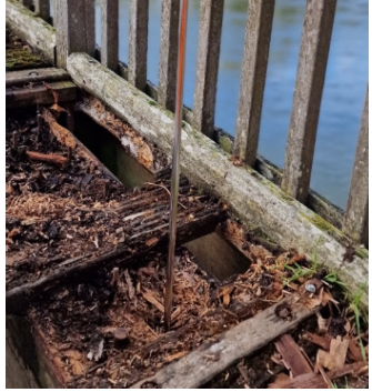
Significant timber decay found in the structural beams that support the bridge deck
Previous update
The central section of the bridge that was removed in November 2025 has now been assessed at its offsite location. Unfortunately, its condition is beyond economical repair and will require replacement.
The side spans were inspected during February 2026 and were found to be in very poor condition. All structural elements including the main supporting beams, deck boards, and parapets show signs of extensive deterioration resulting in a significant loss of structural integrity.
The advanced degradation of the structural beams, along with the complexities of the bridge’s location over the River Thames, mean that refurbishment of the side spans has been deemed non-viable and therefore are also beyond economical repair.
On Thursday 8 November 2025 the main lift to remove the centre span took place. This carefully controlled process included incrementally jacking the section upwards whilst ensuring it was not snagging on the outer spans. The central span was finally fully disconnected from the outer spans after a 9-hour seamless operation.
The centre span was fully lowered and moved to a secure location for inspection and storage.
The river is now fully open for Navigation. You can keep informed on closures at River Thames: restrictions and closures - GOV.UK(External link)(External link).
Contact us
Please note that the most up to date information can always be found on this page. However you can email enquiries_thm@environment-agency.gov.uk(External link)(External link)
You can also phone our National Customer Contact Centre on 03708 506 506 (Monday to Friday, 8am to 6pm)
Boveney to Shepperton (Catchment F)
- local water resources for abstraction
- safe navigation (ensuring we meet our Statutory duties)
- managing flood risk
- the river’s ecology
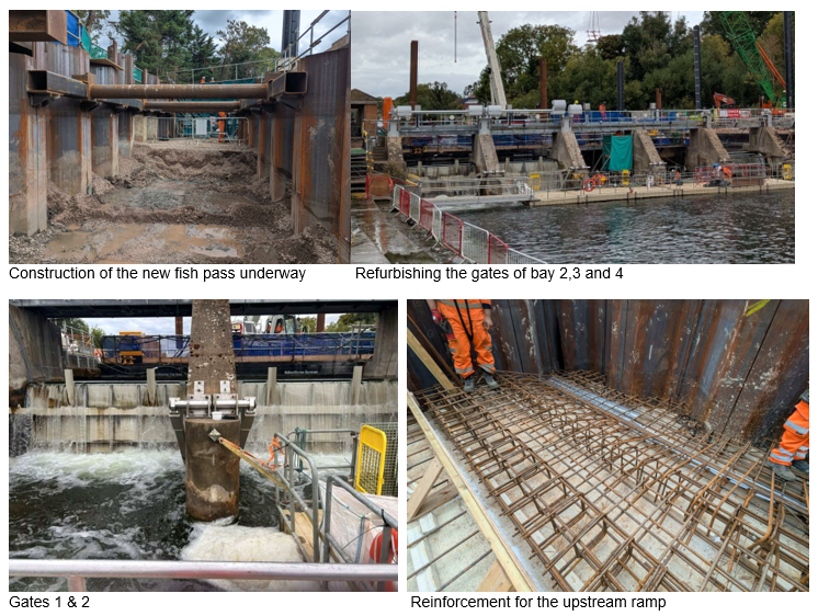
- Completion of fish rescue operations within the fish pass work area prior to construction activities progressing.
- Completion of the main piling works associated with the new multi-species fish and eel pass.
- Installation of concrete foundations and engineered reinforcement for the fish pass structure.
- Continued refurbishment of the main weir, including installation and testing of new weir gates and the associated mechanical & electrical operating equipment.
- Replacement access walkways.
- sign up for flood warnings so you can receive alerts when flooding is expected
- prepare a personal flood plan so you know what actions to take if flooding occurs
- consider practical property flood resilience measures, particularly if your property has flooded before
- Detailed arboricultural assessments have been completed to understand the extent of the tree safety issues across the island.
- Ecological surveys have been progressed, including bat surveys at the proposed mobilisation area. Initial results indicate that no bats have been identified, removing a significant environmental constraint to delivery.
- A project team comprising Navigation Operations, Asset Performance and Project & Programme Delivery has been established to develop and deliver a safe and practical solution.
- Public engagement events have previously been held to explain the challenges, gather feedback and better understand community concerns, including issues relating to memorial trees and benches.
- Preparation of a Flood Risk Activity Permit (FRAP) application required to construct a temporary river-based access point and pontoon that will allow specialist machinery to reach the island. Much of the application has already been prepared.
- Completion of bathymetric and topographical surveys together with outline designs for temporary works needed to support permit approval.
- Discussions with contractors and delivery partners to bring forward tree clearance opportunities and maximise the amount of work completed during the current financial year.
- Progression of further tree and ecological surveys to identify which trees may be addressed using conventional methods before larger mechanical operations commence.
- Continued engagement with local councillors, elected representatives and residents to provide updates on progress and manage expectations.
Bell Weir - Weir Refurbishment
Introduction
We are currently carrying out an extensive refurbishment of the weir at our Bell Weir lock and weir complex on the River Thames in Egham, Surrey. At a total cost of £22m, the work will ensure the weir continues help us manage the level of water in the river to support:
Site set‑up and construction works are now underway as part of this major refurbishment programme.
What work has been started?
In the months since construction began, strong progress has been made, with the following key activities now having substantially progressed.
Fish and eel pass construction
The fish and eel pass will provide an improved route for fish and eels to move upstream and downstream through this section of the River Thames, helping them access feeding, shelter and spawning habitats while improving river ecology.
Following completion of the main piling phase, work has now moved on to excavating and constructing the permanent foundations and reinforced concrete elements that will form the new structure. Specialist teams also carried out fish rescue operations within temporary work areas before construction activities started.
The completion of piling means construction activities are generally expected to generate less noise than was experienced earlier in the summer. We would like to thank local residents and visitors for their patience while these essential works have been carried out.
Refurbishing the main weir
Work is also progressing on the refurbishment of the main weir. During the summer we have been replacing mechanical, electrical and structural components associated with the first weir gates being refurbished. This includes installation of new gate support components, operating equipment, control systems and walkways.
Testing activities are now being carried out on completed elements, while work has also begun on subsequent gates. This phased approach allows us to continue managing river levels safely throughout construction while ensuring the weir remains operational.
What do weirs do?
The very earliest forms of weirs on the Thames were simple barriers installed to trap fish or to raise water levels to power a mill. Modern weirs are much larger and more sophisticated, carefully engineered so that water levels upstream of them can be raised or lowered for the purposes listed above. Some weirs are solid barriers with no moving parts, and some have adjustable gates in them. Most weir complexes on the Thames, including the one at Bell Weir, are a mixture of both..
In all, the Environment Agency owns, maintains and operates 44 lock and weir complexes along the 135 miles of navigable non-tidal river Thames, and one on the River Kennet where it joins the Thames at Reading in Berkshire. They are operated by trained staff from our River Thames Waterways department.
During the summer months, when rainfall is low and river levels naturally drop, weir gates are usually closed. This helps retain water upstream and ensure a safe depth for boating is maintained. It also protects plant and animal species from being adversely affected by excessively low water levels.
Bell Weir weirs also play a critical role in ensuring fresh water continues to be available for abstraction by Thames Water. This water is treated at their Water Treatment Works at Staines and serves a large part of west and north-west London, together with some surrounding areas in Surrey and Berkshire. Our careful management of the river allows this to continue without causing river levels to significantly drop as a result.
In autumn and winter, as river levels rise in response to wet weather, weir gates are opened in a controlled sequence to allow increasing volumes of water to pass through them. This helps prevent water from backing up and potentially overtopping the riverbanks and causing flooding. This continues until all the weir gates are fully open. At this point, this river acts in its natural state i.e., as if the weir wasn’t there.
The weirs at Bell Weir
The Bell Weir weir complex is comprised of a solid ‘fixed crest’ weir, and another weir with 10 adjustable ‘radial’ gates – 9 large, and one small.
The fixed crest weir is a 50m long solid wall. It raises the level of the water until it reaches the point where it flows over the top. The radial gate weir is referred to as the main weir. Each gate in the main weir can be adjusted individually to allow fine control of the upstream water level.
The radial gates in the main weir are curved, like the arc of a circle, with the convex curved section facing upstream. This design makes it easier for the gates to move through the water. Support arms on both sides of each gate extend back to the operating mechanism, which raises or lowers them as required. Radial gates are our preferred type of gate for the non-tidal River Thames, due to their effectiveness and reduced risk of being blocked by debris – such as fallen trees – compared to other types of weir gate.
What does the work we’re doing involve?
Bell Weir’s weir complex had its last major refurbishment in 1967. Almost 60 years later, our regular structural surveys, through which we monitor its condition, have shown that it is now in need of an extensive refurbishment. This will be a major and complex engineering project.
We will replace all 9 of the large radial gates in the main weir, the walkway structure over them and the mechanical and electrical operating equipment. We will also refurbish the main weir concrete substructure, add additional erosion protection and improve the stability of the north riverbank downstream. The small radial weir gate will be replaced with a new multi-species fish and eel pass. This will allow fish and eels to migrate to areas either upstream or downstream of the weir where food, shelter and spawning conditions may be more favourable, helping to increase the number, spread and diversity of fish and eel populations in the Thames. The design of the new large radial gates has been modified to ensure that the weir complex retains the same overall water level management capability as before.
When and how we will carry out the work
Work started in spring 2026 and is planned to be completed by autumn 2027. Our contractor started setting up the site in February 2026, and construction works are now underway. We are replacing no more than two weir gates at a time, so that we can still continue to manage water levels. A temporary dam has been placed around the weir and the water has been pumped out so that work can be carried out safely in dry conditions.
A temporary construction compound has been established with access to the river at Runnymede Pleasure Ground, with vehicle access from the A308 via an existing entrance to the car park.
A smaller satellite compound has also been established on the southern bank next to the weir. Barges are being used to transport construction machinery and materials by river where possible.
Bell Weir lock will remain operational throughout.
There will be some disruption while work is being carried out. This will include a small increase in traffic, the visual impact of construction equipment and reduced availability of the Pleasure Ground. We will, however, do all that we reasonably can to reduce any disruption while we carry out this essential work.
Unfortunately, we have had to divert the Thames Towpath (Thames Path National Trail) at the Runnymede Pleasure Ground while work is being carried out. We apologise for any inconvenience this may cause.
Managing environmental impacts
Measures are being put in place to protect local wildlife and prevent disruption to tree and vegetation species, and to monitor the site from an archaeological perspective.
An Ecological Clerk of Works (ECoW) will supervise and advise on repurposing of left over materials to benefit wildlife.
Planning and permissions
Work will be carried out under the Environment Agency’s Permitted Development rights (The Town and Country Planning General Permitted Development (England) Order 2015, Schedule 2 Part 13, Class D). A Certificate of Lawful Development has been obtained from the local authority.
Some history of Bell Weir lock and weir site
Bell Weir lock and weir site was built in 1818 by the Thames Commissioners as part of a programme of works carried out between 1817 and 1845. In total, 7 new locks were built at this time, 2 of them as replacements to earlier locks at existing sites. The walls of the lock were originally made of timber, and the weir was a ‘paddle and rymer’ type, a version of one of the oldest types of weir used on the Thames since the 13th century. They consist of long posts (rymers) that fit into a slotted beam or cill on the river bed. This creates a supporting framework that allows sections of wood to be dropped between the posts and stacked up to create a barrier. The sections of wood have handles attached to them, making them look like a crude form of paddle, hence the name ‘paddle and rymer’ weir. This original weir can be seen in the background of the picture below:
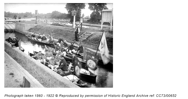
Originally was known as Egham Lock. It was later renamed after Charles Bell, who ran a nearby inn called The Anglers Retreat and was responsible for operating the lock and weir.
The weir has had a few dramatic moments. It collapsed in 1827 under the weight of ice, and the lock itself failed in 1866. Both were rebuilt the following year, and the lock was reconstructed in stone in 1877. A new weir was added in 1904, and refurbished in 1967.
Bridge 142 - Egham
Background
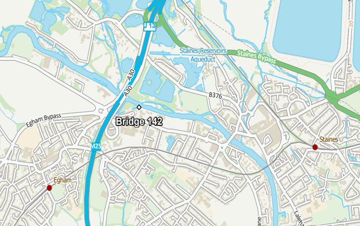
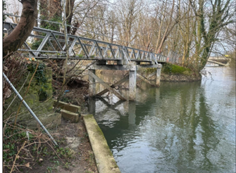
Following a tree strike in 2023, an inspection of the 90-year-old structure identified significant safety concerns, including cracking within the cast iron elements and the bridge supports. Ensuring public safety is our highest priority, and as a result, unfortunately Bridge 142 and a section of the Thames Path were closed in February 2024. A signposted alternative route remains in place.
Recent Updates
The Environment Agency plans to remove the unsafe bridge in autumn 2026. Work is currently underway to design and manufacture a replacement bridge, which is expected to be installed in summer 2027. To remove and replace the existing bridge, our contractor requires more aerial space, and we will need to remove a few trees near the bridge. The footpath will remain closed until the new bridge is installed and reopened, and the diversion route will remain in operation until then.
Previous update
Our project delivery team is currently focusing on the necessary environmental surveys to help inform the overall project scope, and these have took place during week commencing 10 November 2025. Similarly, ground investigation specialists were on site on 14 November 2025 to help detail the overall specification of the bridge replacement. Unfortunately, it is not possible to provide an exact date for completion of the work to replace the bridge. We will, however, progress this work as soon as possible alongside the competing priorities of our wider Navigation capital investment programme.
We will provide a further update later this year with more details.
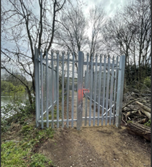
We are aware of trespass and vandalism to our security fencing at this location. The security fencing will have to remain in place while we develop the project, and our local team will continue to regularly monitor any further illegal activity.
We urge people not to force or tamper with the fence so that we can maintain safety for all.
The route of the diversion can be found on the National Trails website here: Temporary Diversion near Runnymede Bridge - National Trails(External link)(External link)
The Environment Agency apologise for the ongoing inconvenience and thank you for your patience while we work to deliver a safe replacement new bridge.
Contact us
If you see damage at this site or any other of our assets, please call our 24-hour Incident Hotline on 0800 80 70 60. More information can be found at https://www.gov.uk/report-environmental-problem(External link)(External link)
You can also phone our National Customer Contact Centre on 03708 506 506 (Monday to Friday, 8am to 6pm).
Please email enquiries_thm@environment-agency.gov.uk(External link)(External link) if you have any further queries, however, please note that the most up to date information is on this page.
Old Windsor Lock - Overflow Channel Wall
Condition And Funding Update
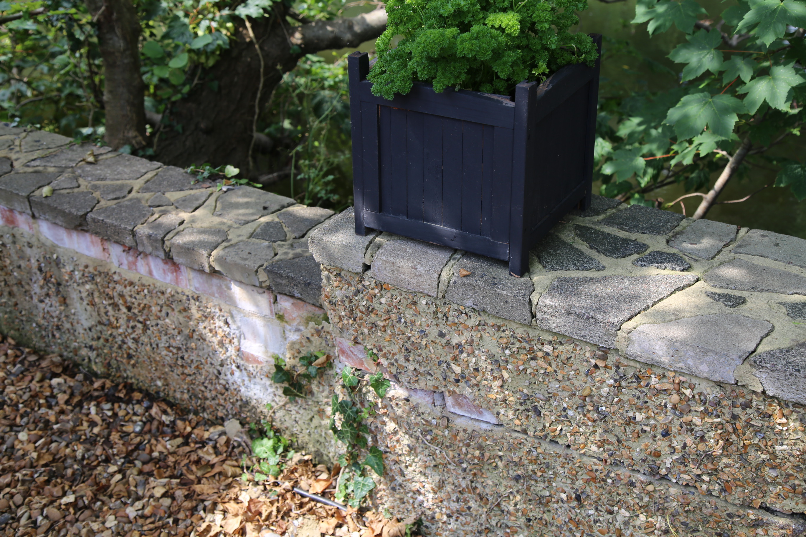
What is the wall for?
The wall was originally built as part of the Old Windsor lock complex and was not designed or constructed as a flood defence. Since it was built, development has taken place on the island. The local area has changed from agricultural land to a built-up area.
Although the wall is not a flood defence, it can help slow down flood water reaching nearby properties in the onset of a flood. However, it does not prevent flooding altogether.
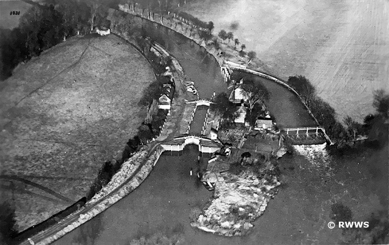
What is the current situation?
We have carried out surveys which show that the wall needs repair. We are aware of local concerns and understand the importance of maintaining assets that help manage the effects of flooding.
We submitted a funding bid to carry out refurbishment works but were unsuccessful on this occasion. While the current funding approach provides more opportunities for refurbishment projects than in the past, it is a very competitive process as there are more eligible projects than funding available. As a result, investment must be prioritised to ensure it delivers the greatest benefit to people and communities at risk of flooding.
We will continue to apply for funding to repair the wall. We will also continue to monitor the condition of the structure and review its status alongside other priorities across the Thames area.
We have begun the preparation work needed for the refurbishment of the Old Windsor lock complex. Unfortunately, it is not possible to repair the wall as part of these works.
What can I do?
We encourage residents to be prepared for potential flooding:
You can find further information on flood warnings and preparing for flooding on GOV.UK.
What are the rights and responsibilities of riparian owners?
There are responsibilities and rules to follow if there is a watercourse on or near your property. Permissions may be needed before carrying out work in or near the watercourse or associated structures; further guidance is available on owning a watercourse and permissions for work on or near a river or flood defence on GOV.UK.
Penton Hook Island Closure
Background
Penton Hook Island is unfortunately closed to the public because widespread tree safety issues, mainly linked to Ash Dieback disease, create an unacceptable risk of falling branches and tree failure. Our surveys and subsequent assessments found that a significant proportion of the island's tree stock presents this risk.
The island contains approximately 300 mature trees and we recognise how important it is to the local community, especially given the numerous informal memorial trees and benches, making the closure particularly sensitive for the local community.
.
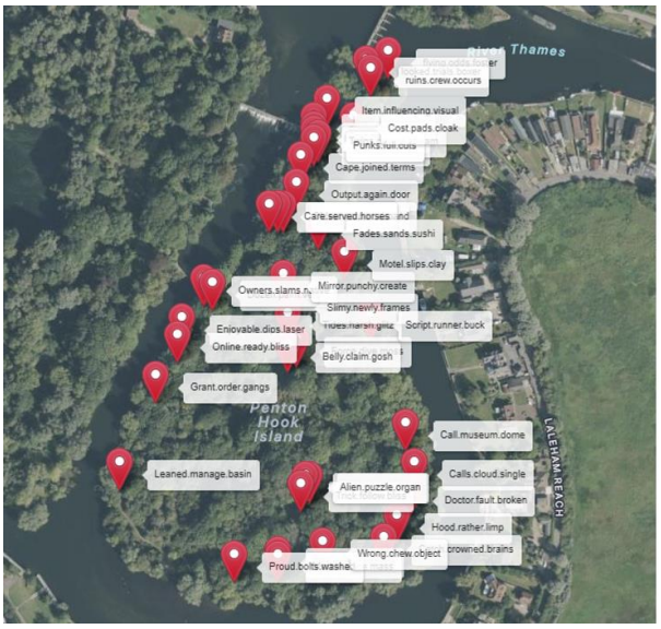
Actions Completed
A number of important preparatory activities have now been completed:
Actions Currently Being Progressed
The project is now focused on ensuring safe access for contractors while accelerating the delivery of tree management works
Key activities underway include:
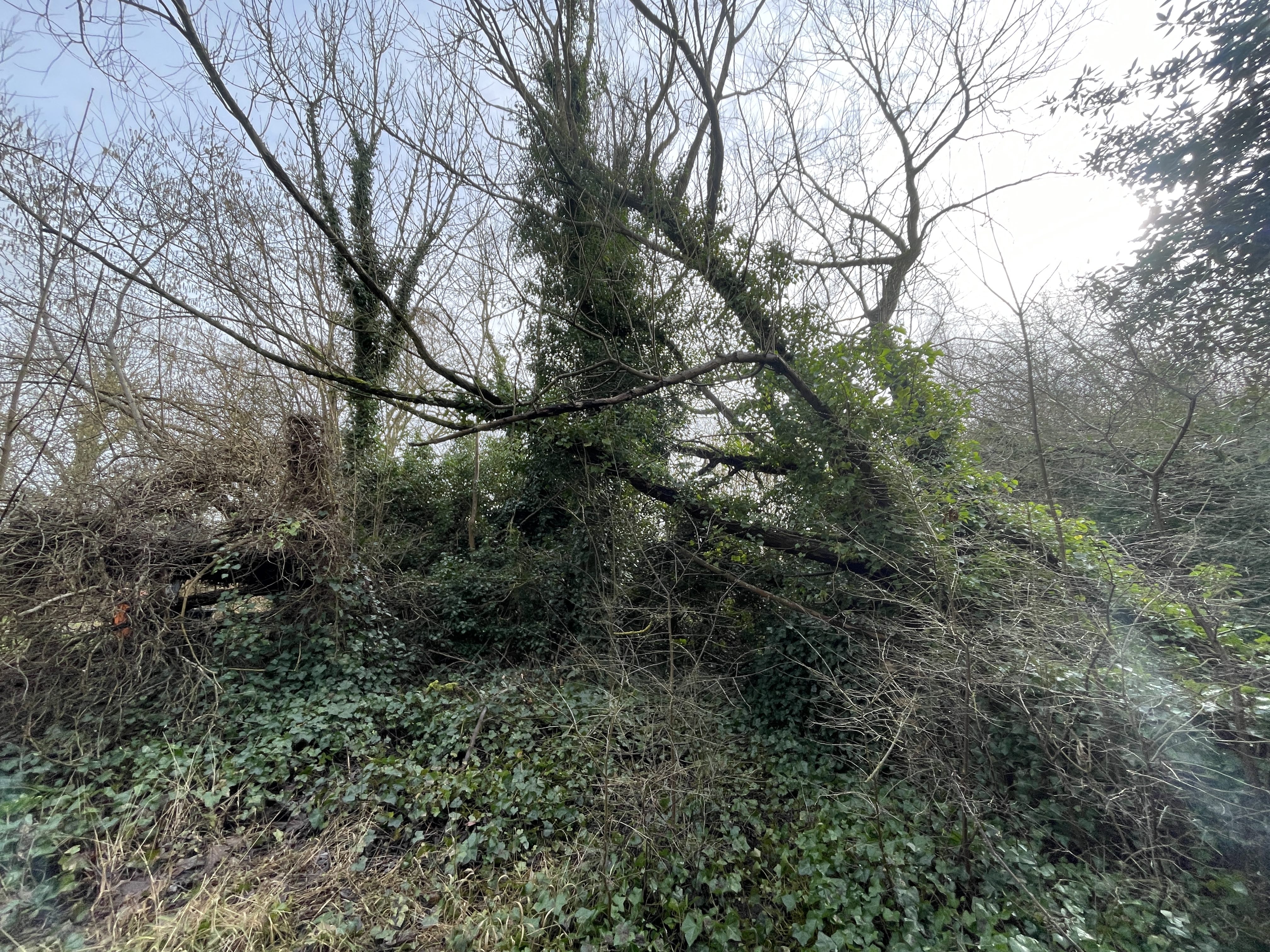
Impact on the Public
The island will remain closed to the public while the identified tree safety risks remain unmanaged. Environment Agency health and safety specialists maintain that reopening the island before the completion of the necessary remedial works would present an unacceptable risk to public safety due to the potential for falling trees and branches
In the short term, local residents, walkers, anglers and families with memorial trees or benches on the island will continue to experience no access. However, the work currently underway is intended to create a safe and deliverable programme for tree management, ultimately enabling decisions on the future use and potential reopening of the island. The project team also intends to continue engagement with the community regarding memorial features, future planting opportunities and the longer-term vision for the site.
Key Message
Good progress has been made in removing several critical environmental and permitting barriers. The project has now moved into the delivery-planning phase, with the focus on securing permits, enabling site access and accelerating tree works. While the island must remain closed for public safety reasons at present, the programme is actively progressing towards a long-term resolution that protects both public safety and the island's value as a community asset.
We apologise for any disruption the island closure continues to cause. We know the importance of this site to the local community, and we are committed to delivering a solution and keeping everyone updated on our progress.
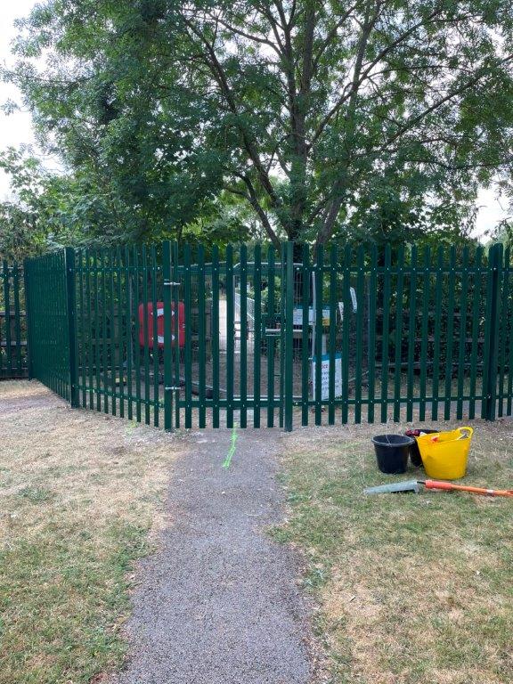
Our staff at Penton Hook Lock will continue to advise members of the public with general queries about our work to support boating but won’t be able to answer further questions about this tree management work.
Please email enquiries_thm@environment-agency.gov.uk.You can also phone our National Customer Contact Centre on 03708 506 506 (Monday to Friday, 8am to 6pm). Please note, all current updates will be posted on this page as soon as information becomes available.
Sunbury to Teddington (Catchment G)
- Ground investigations undertaken and completed
- Lock gates removed from the lock chamber and transported to the workshop for refurbishment
- Propping installed in the lock chamber to support the lock walls during construction
- Temporary stop log barriers established, allowing the dewatering of the lock chamber
- Further scanning and investigations into the strength and structure of the lock walls
- Fish rescue of an estimated 5,000 fish across 11 species, from the lock chamber during dewatering
- Lock wall reinforcement works commenced
- Lock gate repairs are progressing well
Teddington Lock Launch Repairs
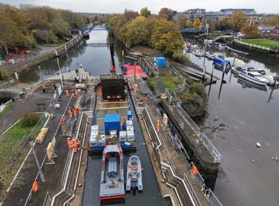
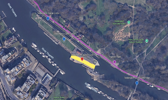
The Environment Agency is carrying out improvement works to refurbish and recondition the Teddington Launch Lock that will result in a reliable, operational lock, for decades to come.
In September 2025, our construction partner, Bam Nuttal, mobilised to site to begin the refurbishment works. A summary of the project’s progress to date can be found below:
Please note, the Thames path at Teddington Lock and Ham Street car park will have minor diversions for short periods of time throughout the works and will be clearly marked on site. At all other times the Thames Path remains open as usual. Diversions will not impact Teddington Footbridge. We are continuing to work closely with Richmond and Wandsworth Councils to give advanced warning of any diversions and to limit the inconvenience to our customers.
Use of the Teddington Barge Lock will continue throughout construction to maintain navigation.
Current Progress – June 2026 Update
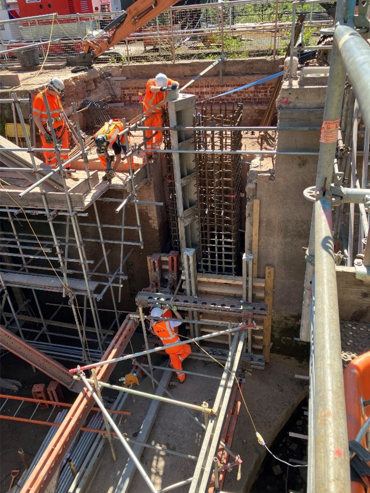
Refurbishment is progressing at both ends of the lock, with damaged sections being carefully excavated. Our contractor has also reinforced the lock chamber walls using steel rods, and this work is now nearly complete.
New concrete foundation walls are being built, and steel recesses (quoins) have been constructed into the lock walls to facilitate the operation of the lock gates. This aspect has proven particularly challenging due to the precision required. In certain cases, dimensional tolerances must be maintained to within ±1mm to ensure correct operation of the lock mechanism.
The project is particularly difficult due to the lock being over 100 years old. We were only able to fully understand its condition and take accurate measurements after the water was drained and detailed scans were carried out earlier this year. It is likely that over the years, part of the structure has changed from our as-built records, meaning the current design has needed to be adjusted as construction progresses to make sure everything is fit for modern purpose.
As a result, the complexity of the design and reconstruction work means the project is taking longer than originally expected.
The lock gates are undergoing refurbishment at the factory and will be reinstalled at the lock later this summer.
Figure 1 –Refurbishment works underway at the upstream-end of the lock. New concrete being poured to secure the new stainless steelQuoins being installed.
Next Steps
The focus will be on installing the new supporting structures in preparation for putting the lock gates back in later this summer. At the same time, detailed planning is underway for the testing that will be needed once the gates are reinstalled. The gates need to be tested both when the lock is empty and when it is filled with water. This means the lock chamber will need to be filled and drained several times. Testing will be carried out on the new mechanical and electrical equipment being installed to make sure everything is working properly.
The project team has been working hard to get the lock back in operation by the end of the boating season. However, due to the complexity of the refurbishment and the extent of the structural improvements required, this is now unlikely to be achieved.
It is currently anticipated that the launch lock will be back in operation in the autumn. Some additional works will continue at site beyond lock’s re-opening. These works are expected to conclude in the Winter
Use of the Teddington Barge Lock will continue throughout construction to maintain navigation.
Contact us
If you see damage at this site or any other of our assets, please call our 24-hour Incident Hotline on 0800 80 70 60. More information can be found at https://www.gov.uk/report-environmental-problem(External link)(External link)
Please email enquiries_thm@environment-agency.gov.uk(External link)(External link) if you have any further queries, however please note that the most up to date information is on this page.
You can also phone our National Customer Contact Centre on 03708 506 506 (Monday to Friday, 8am to 6pm).
Previous Update
We successfully dewatered the lock in February 2026 enabling us to inspect the structure and plan the necessary refurbishment works in detail. As part of the dewatering activity, we worked with ecologists ‘FiveRivers’ who carried out electro-fishing to safely remove any fish from the works area. They relocated an estimated 5,000 fish from the lock, across 11 fish species. To safely remove the fish, they were placed into oxygenated holding tanks and then released back in the River Thames at a suitable location.