
More information about our project
- The sea will slowly move towards the new embankment, which will result in a gradual dying back of the lower lying existing vegetation. That area may look muddy and watery, in preparation for the new habitat to start growing.
- You might see birds like egrets or curlews exploring the new space.
- The ground will be soft, with the tides bringing in mud and nutrients.
- Salt-tolerant plants like glasswort and sea aster will be establishing.
- Mudflats will be forming. These are rich feeding grounds for birds.
- You’ll start to see more wildlife: crabs, worms, and wading birds.
- A saltmarsh and mudflat habitat will have developed and will be changing as the sea level rises.
- It will be home to Brent geese, lapwings, and young fish.
- Supports rare and protected species. Replaces lost saltmarsh and mudflat in Chichester Harbour.
- Creates a safe space for birds to feed and nest and a great chance to see them along the new embankment with binoculars!
- Acts like a sponge, reducing flood risk to the western side of Thorney Island Barracks.
- Acts as a carbon sink.
- Continues to be a good place for walking and wildlife watching.
Why do we need to create habitat?
Intertidal habitats in Chichester Harbour like saltmarshes and mudflats are disappearing. These special coastal areas are important homes for wildlife and help protect the coastline from flooding. As sea levels rise, these habitats would move naturally to find the conditions that they prefer, for example to find more or less salt or water.
Over time, flood defences have been built to protect properties and land from the sea. With rising sea levels in front and a flood defence behind, some habitats are being lost as they are ‘squeezed’ between the two. This is known as coastal squeeze. Here is an animation about coastal squeeze: What is Coastal Squeeze?
Once habitat disappears, it is hard to restore. That is why the Environment Agency has a legal responsibility to compensate for the habitat lost because of flood defences and allow new areas of saltmarsh and mudflat habitat to flourish.
To find out more about habitat compensation, click here to find out about the Environment Agency’s Habitat Compensation and Restoration national programme: https://southerncoastalgroup-scopac.org.uk/hcrp/
What is special about saltmarshes and mudflats?
Saltmarshes and mudflats are types of intertidal habitats. These habitats are very important because they: provide homes for birds, fish and other wildlife; help reduce the impact of waves and flooding and capture and store carbon, which helps tackle climate change.
Chichester Harbour has already lost more than half (58%) of its saltmarsh since 1946, and more is disappearing every year. You can read a report from Natural England about this here: https://publications.naturalengland.org.uk/publication/5535304204419072
Our project at Thorney Island is helping to mitigate this loss and restore one of the England's most valuable coastal environments for future generations.
What is managed realignment?
Managed realignment means changing the shape of the coastline by breaking or moving coastal defences, allowing water to move inland and flood low-lying land, and providing new coastal access route.
It’s called “managed” because it’s carefully planned, not just letting nature take over but working with nature and communities to keep people safe from flooding and support wildlife.
What will happen if we do nothing?
If things stay the same, the defences will become increasingly damaged during storm events. Eventually, sections of the defence will become more damaged and may eventually breach The area behind the embankment will flood more frequently. This could flood the coastal footpath that people use making the area unsafe at times.
Along the Thorney Island coastline, saltmarsh and mudflat habitats will continue to disappear due to increasing sea level rise and coastal squeeze impacting wildlife found on the site.
Rather than allowing the defence to naturally fail in a big storm event, we want to manage the current embankment by allowing it to break in a controlled manner.
What will the area look like when finished?
Over time, the land behind the breached sea wall at Thorney Island will slowly transform into a natural coastal wetland. This won’t happen overnight — it’s a gradual process that takes years, even decades.
In the First Few Years
After 5–10 Years
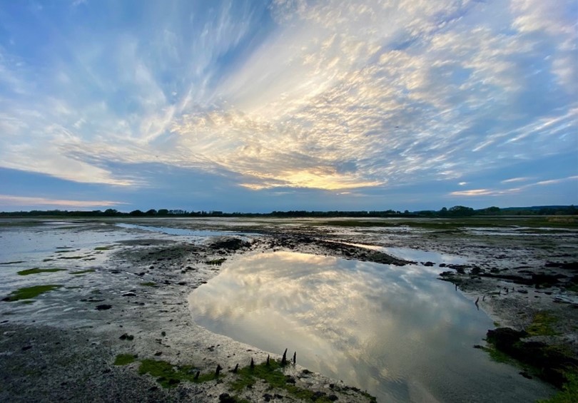
Wide view of intertidal mudflats at low tide
After 20+ Years
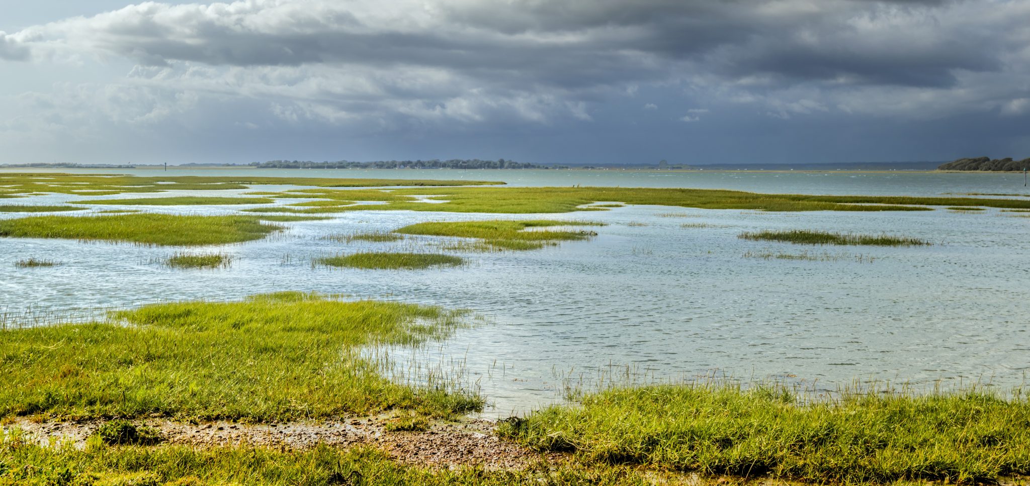 Saltmarsh habitats and tidal channels across the harbour, showing the dynamic coastal landscape shaped by the movement of water and sediment.(Courtesy of Chichester Harbour Conservancy)
Below is a representation of what the process of intertidal habitat creation may look like over time.
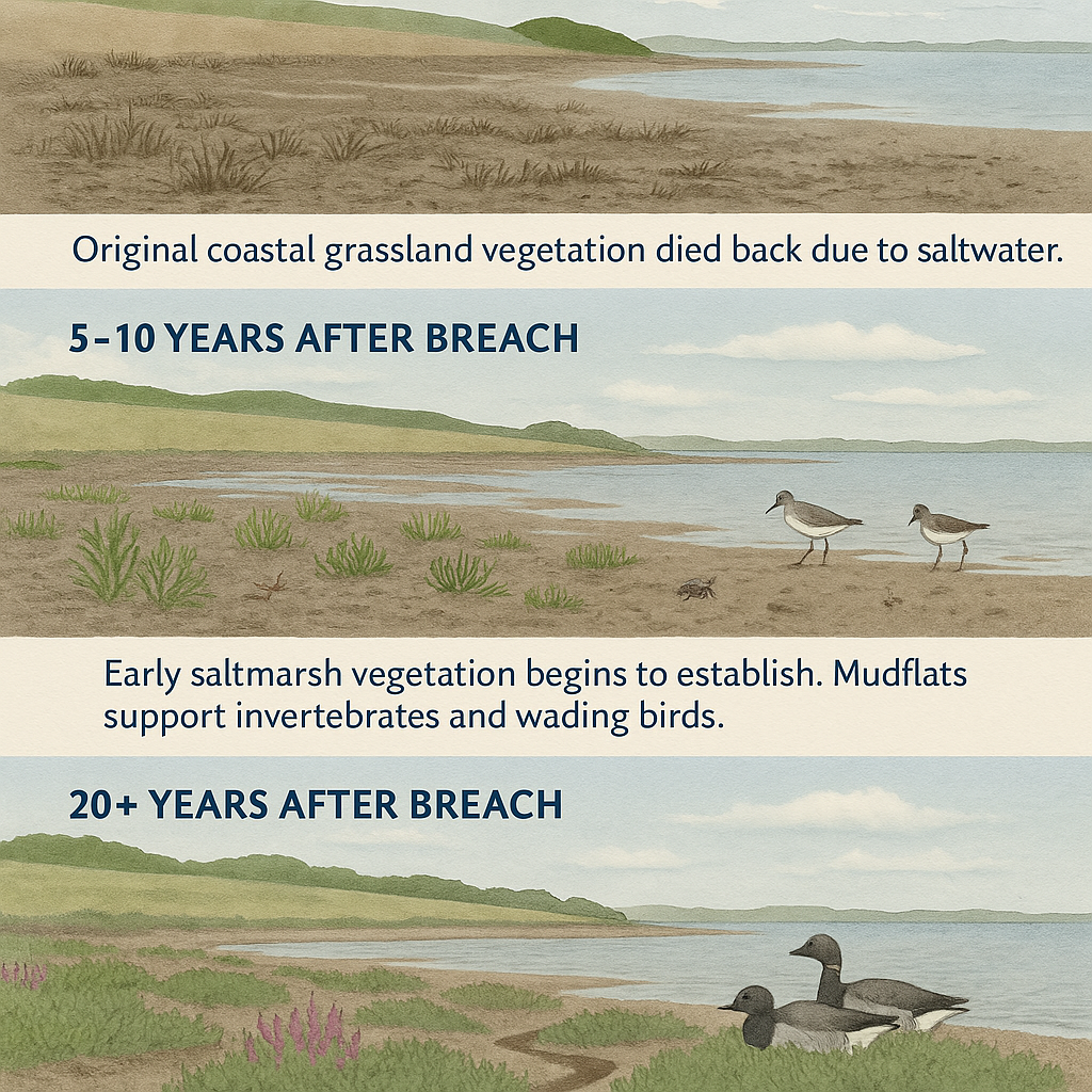
How habitats change over time following a managed realignment breach, from unvegetated mudflats to established saltmarsh supporting a wide range of wildlife.
This new habitat will bring many benefits listed below
What is being done to protect wildlife and the local environment?
Protecting people, wildlife and the environment is a key part of the project. Before any work takes place, specialists carry out detailed surveys to understand the site, including local wildlife, ground conditions, archaeology and any other environmental sensitivities.
The findings from these studies will help inform the project's Environmental Impact Assessment and Environmental Statement, which assess potential environmental effects and set out how impacts will be avoided, reduced or managed.
The project team works closely with environmental experts, engineers, archaeologists, the Ministry of Defence and local planning authorities to make sure risks are properly considered. Construction activities will also be carefully timed, where needed, to minimise disturbance to wildlife and habitats.
Once the project is complete, the site will continue to be monitored to check how habitats are developing and to ensure any environmental issues are identified and addressed.
How are we making sure the site is ready for habitat creation?
One of our key goals is to leave the land in a better condition and ready for the creation of new saltmarsh and mudflat habitat.
To help us plan the project, we have carried out detailed surveys and ground investigations across the site. This work has helped us better understand the area's geology, water levels, wildlife, archaeology and historical land use. It also identified areas where traces of DDT, a pesticide widely used during and after the Second World War, remain in the environment.
The presence of DDT in parts of Chichester Harbour, including Thorney Island, is well known and has been studied for many years. The levels identified on the site are considered safe for its current use. However, because the project will change how seawater moves across the site, we want to fully understand whether carrying out the work could affect the movement of DDT and whether this could have any implications for people, wildlife and the wider harbour environment.
To do this, we have worked closely with environmental specialists, the Ministry of Defence, Chichester Harbour Conservancy, Natural England and Environment Agency experts. Together, we have carried out detailed investigations, assessments and modelling to identify the best ways to manage the land and reduce any potential risks.
Additional ground investigations were completed in late 2025 and have provided valuable new information. We are now reviewing the findings to help shape the next stage of the project.
Before any construction takes place, we will carry out all necessary checks and put appropriate measures in place to ensure any contaminants are managed safely, protecting people, wildlife, habitats, soil and water.
By taking a careful, evidence-based approach, we can create valuable new habitat for wildlife, improve the condition of the land and help this special place thrive for future generations.
Where will I be able to walk?
At the moment, walkers use the circular coastal path around Thorney Island, although sections can sometimes be flooded or damaged during stormy high tides. As sea levels rise, this is expected to happen more.
A new, safer footpath will be built further inland before the existing route is moved. The project team is already working with our partners to help make this transition as smooth as possible. There may be some short periods of disruption during construction to keep everyone safe.
Once the existing embankment has been breached, the new set-back footpath will be the main route for walkers.
Will the project impact access for boats or other water-based recreational activities in the harbour?
The project involves realigning part of the western side of Thorney Island coastline, by allowing seawater to flood some of the land at Thorney Island.
There are unlikely to be any significant impacts on water vessels in the adjacent channel. However, there may be minimal changes to current strength and direction in the locality of the newly created breaches.
In a few years when the sea level has risen, water may sit more permanently within the outer stretches of the original land areas along the coast. The project team will be investigating the need for navigational markers to highlight the lower water along this stretch as the project progresses.
How can I get involved and learn more about the project?
There will be opportunities to get involved as the project progresses. We are planning future engagement activities, including face-to-face events planned to be in Spring 2027. These will be advertised closer to the time.
You can also stay up to date by visiting this platform regularly for the latest project news and frequently asked questions which may be updated as we receive feedback from the community.
If you have any questions, please get in touch with the project team via our project inbox.