July 2026 - St Ives Sluice
Moderation Project update
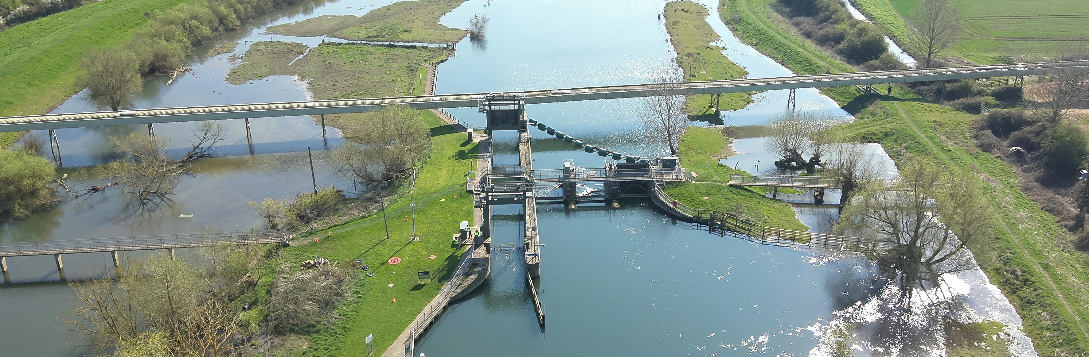
We are progressing plans to maintain water levels for navigation at St Ives on the River Great Ouse, helping to meet our legal responsibilities and support the continued use of the river by boaters and other waterway users.
Why is this project needed?
The existing St Ives sluice structure contains seven moveable gates that help manage water levels upstream. As the structure ages, we need to identify the most sustainable and cost-effective way to continue maintaining the required navigation water levels in the future.
What options were considered?
A range of options was assessed, including:
- Continuing with maintenance only and making no major changes.
- Replacing all seven sluice gates with new gates.
- Installing a fixed crest weir within the existing structure.
- Installing a fixed crest weir downstream of the existing structure.
- Installing permanent stop logs while retaining some or all of the existing gates.
The assessment considered not only the initial construction costs but also the long-term costs of operating and maintaining the structure over its lifetime, as well as impacts on flood risk in the area.
Why is the chosen option being proposed?
Following a detailed assessment of options, a fixed weir (either at or downstream of the site of the existing structure) has been identified as the preferred option, subject to the necessary approvals and assurance processes.
Fixed weirs are a proven and widely used method of managing water levels. Unlike a gated sluice, a fixed weir operates passively and does not rely on moving mechanical equipment.
This provides several benefits:
- Continued ability to maintain the statutory navigation water level.
- Ongoing support for flood risk management functions.
- Improved reliability.
- Reduced risk of mechanical failures.
- Lower long-term maintenance requirements.
The Environment Agency owns, maintains and operates 44 lock and weir complexes along the 135 miles of navigable non-tidal river Thames, and have similar assets and asset complexes on the river Great Ouse.
The fixed weir options show a resulting impact on flood depths but no increase in flood risk to properties. The greatest expected increase in flood depth is 50mm but with no change to flood extents and therefore, no additional properties are at risk of internal flooding. For further detail on the hydraulic modelling used to support this assessment please see the FAQs to the right of the page.
What happens next?
The cost to deliver this option is expected to be ~£4-5m so we must go through additional steps than previously anticipated to justify and gain approval to deliver the project. This means construction is now planned for 2027/28 instead of 2026/27.
As the project progresses, we will provide further information about the design, programme, and any impacts on navigation or local communities. Any temporary restrictions or changes required during construction would be communicated well in advance.
