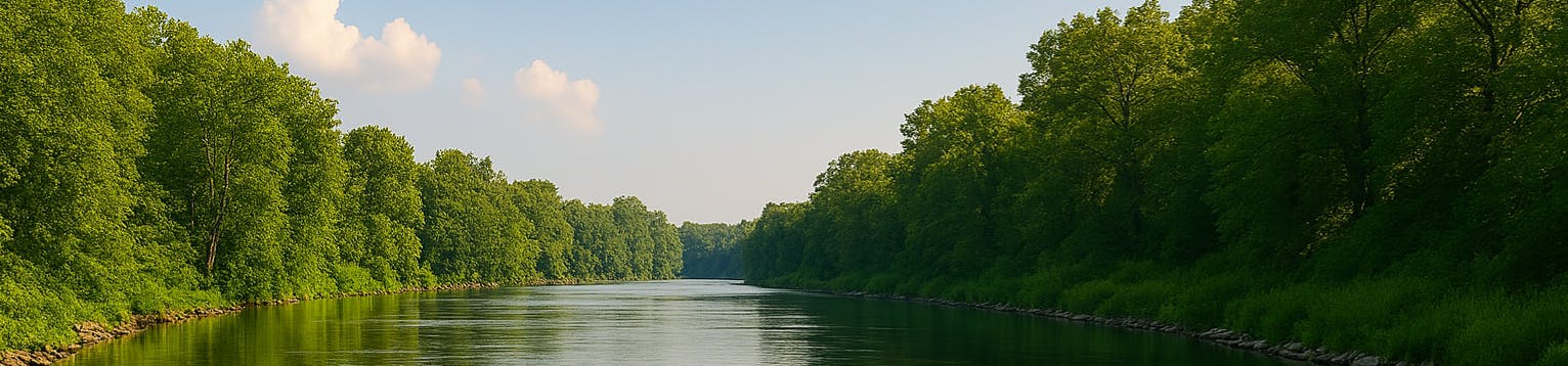
EA Maintenance

    What maintenance are we undertaking?

    Please see the Maintenance and Future Maintenance document under the Asset Management tab in this page. 

    What is dredging and why won't we always dredge?

    Dredging means different things to different people. Within the Environment Agency we mean removing accumulated material in the river to maintain the conveyance of the channel. This includes material like gravel or soil (often referred to as silt) that has been washed into rivers from somewhere else, as well as rocks and plant life. Other maintenance activities such as in-channel weed clearance, blockage removal and vegetation management are also important to maintain the conveyance of channels.

    We assess each situation individually and dredge when it is the right solution, and it provides long-term value for money. Understanding where it will, and will not, reduce flood risk is key.   

    Hydraulic modelling was undertaken on Mill Dam Dyke in 2020, the results of this modelling was used in 2023 when the EA commissioned an Optioneering Assessment Exercise and Report for Mill Dam Dyke. As part of the exercise siltation scenarios on the Mill Dam Dyke were run and included in the assessment. This showed that siltation has no significant change in flood extent. The Hydraulic Modelling undertaken in 2020 showed no silt in Mill Dam Dyke until the section where is joins the Fleet and then it is at a low level.

    During the winter of 2023/24 we arranged for a small section of silt to be removed from the bend in Mill Dam Dyke at the corner of School Lane and Chapel Lane in a targeted desilt and we will carry out silt levels checks in the future, this does not mean we will automatically carry out any dredging of Mill Dam Dyke.

    Dredging contributes to reducing flooding in some locations, but in others it is extremely inefficient and ineffective because rivers can quickly silt up again and other measures such as building walls or storage upstream are more effective. 

    We don’t dredge a watercourse if it is not an effective way to reduce flood risk and therefore represents poor value for money in comparison to other flood risk measures.  

    What is 'Main River'?

    Watercourse Definition

    Main River vs Ordinary Watercourse

    What is a watercourse? Watercourses can be described as ‘a natural or artificial channel through which water flows’ and includes rivers, streams, brooks, becks, culverts, and ditches. There are two types of watercourses: main rivers and ordinary watercourses. It is worth noting that just because a watercourse has the word 'River' in its name, doesn't mean it is a 'main river'

    Main River

    These are usually larger watercourses or sections of larger watercourse which are designated as a ‘main river’ on the Environment Agency’s (EA) Main River Map. The EA carry out maintenance, improvement and construction work on these main rivers to manage flood risk for the catchment.

    Ordinary Watercourse

    These can include watercourses such as some rivers, brook, beck, ditch, dyke, stream, leat, goyle, rhyne or culvert. The Lead Local Flood Authority (LLFA), Lincolnshire County Council and the Internal Drainage Board (Shire Group IDB) are responsible for managing flood risk and carrying out flood defence work.

    Riparian Ownership can be present on both types of watercourses.

    Please see the Important Links section of this Engagement Page for more information on owning a watercourse and your rights and responsibilities.

    The Flood Hub Website contains some useful information on Riparian Ownership.

Owning a Watercourse

    How do I know if I own part of a watercourse?

    Riparian ownership

    A riparian owner is somebody who has either a main river or an ordinary watercourse, such as a stream or culvert, running through, beneath or adjacent to the boundary of their land. If the watercourse forms the boundary of the land, you will usually own it up to its centre. If you are unsure about your ownership, you can check your title deeds on the land registry.

    You may have to remove blockages, fallen trees or overhanging branches from your watercourse, or cut back trees and shrubs on the bank, if they:

    • reduce the flow or cause flooding to other landowners’ property – you may have to pay damages if they do

    What are my Riparian responsibilities if I own part of a watercourse?

    Riparian ownership

    A riparian owner is somebody who has either a main river or an ordinary watercourse, such as a stream or culvert, running through, beneath or adjacent to the boundary of their land. If the watercourse forms the boundary of the land, you will usually own it up to its centre. If you are unsure about your ownership, you can check your title deeds on the land registry.

    You may have to remove blockages, fallen trees or overhanging branches from your watercourse, or cut back trees and shrubs on the bank, if they:

    • reduce the flow or cause flooding to other landowners’ property – you may have to pay damages if they do

    The requirements of this can be found at the following location Owning a watercourse - GOV.UK (www.gov.uk)(External link).  A more detailed attachment called Your Watercourse: Rights & Roles can be found here Your watercourse: rights and roles | Engage Environment Agency (engagementhq.com)

Is there an option for a Capital Scheme?

    Is there an option for a Capital Scheme?

    In the East Midlands, the Environment Agency has undertaken a strategic review of the area, to identify those communities most at risk and to identify where the most benefits can be gained from investment of flood defence grant in aid, as well as exploring partnership opportunities with our professional partners and communities. The Environment Agency reviews the investment programme regularly to take account of new flooding information and data, and partnership funding opportunities.

    Unfortunately, there is not currently a project on the investment programme for the area of North Scarle and it is unlikely that an economically viable project would be able to be developed in this area.

    Can I find a completed optioneering report?

    Please check the 'Documents' tab for a report called "Mill Dam Dyke Optioneering Assessment Report". 

    What results has the recent modelling shown?

    A hydraulic model is a collection of mathematical equations that give a simple representation of reality. They estimate flow, water level and velocity in river channels. pipe networks. tidal systems.

    Hydraulic modelling was undertaken on Mill Dam Dyke in 2020, the results of this modelling was used in 2023 when the EA commissioned an Optioneering Assessment Exercise and Report for Mill Dam Dyke.

    The Optioneering Exercise looked at several potential engineering interventions for Mill Dam Dyke and they are summarised in the Report.

    As part of the exercise siltation scenarios on the Mill Dam Dyke were run and included in the assessment. This showed that siltation has no significant change in flood extent. The Hydraulic Modelling undertaken in 2020 shows no silt in Mill Dam Dyke until the section where is joins the Fleet and then it is at a low level.

    Overtopping:

    The modelling shows that the main area that Mill Dam Dyke may overtop is at the corner of School Lane and Chapel Lane which is the start of the Environment Agency Embankment. There was no evidence of overtopping here during the winter of 2023/24.

    At no other point does the right bank, and therefore the embankment, overtop. This is due to the left side of Mill Dam Dyke (Non-Environment Agency Asset) always being at a lower elevation, encouraging the watercourse to flood the local agricultural land to the left.

    It should also be noted that Mill Dam Dyke overtops adjacent to Swinderby Road in several places when the channel becomes constrained by a bridge (private or 3rd party asset) running across the channel. There is also evidence of this on Chapel Lane (private access bridge). It should be noted that properties in Swinderby Road and Chapel Lane do not sit behind Environment Agency Defences (see overview of assets document under Asset Management on this page).

    A number of options were looked at and these can be reviewed by reading the report, which can be found in the Optioneering Assessment Report (see Asset Management documents in this page). 

    The Optioneering Assessment found that many sections of the Embankment are above a 1 in 100-year return period. The final recommendation from the assessment shows that any portion of the embankment that was above this level could be removed without impacting flood risk to the stakeholders in the area.

    Please note that this will not happen without consultation and would be subject to the EA being able secure the level of funding which would be required.

    Reducing the height of the embankment would reduce the steepness of the embankments and allow maintenance to be undertaken in a more efficient manner.

    What is the EA able to do about surface water flooding?

    Surface water flooding generally occurs in urban areas when water cannot drain away or soak into the ground. It can happen very quickly and is difficult to predict.   

    Lead local flood authorities (LLFAs), which are unitary or county councils, have the principal role for managing the risk of flooding from surface water in their area. This includes understanding the risk and planning to manage it.  

    The Environment Agency has a strategic overview role for all sources of flooding, which includes surface water. Through this role, we show strategic leadership by playing an active role in supporting local authorities and other partners in enabling them to plan and adapt to current and future surface water flood risk.  

    Anyone can check their risk from surface water flooding: Check the long term flood risk for an area in England - GOV.UK (www.gov.uk)(External link)  

    Will the risk of flooding increase with climate change?

    Our climate is changing, sea levels are rising, and we are experiencing more extreme weather. 

    We are already seeing these changes: 2022 was the warmest year on record in the UK. In July 2022 recorded temperatures exceeded 40C for the first time in the UK. 

    Long term records show that in the UK: 

    • temperatures are rising. 
    • more rainfall in winter is falling in heavy events. 
    • sea levels are rising more rapidly than in the past. 

    The scale of potential future flooding and coastal change is significant. One in 6 people are already at risk of flooding from rivers and the sea. The risks will only increase with rising sea levels, more frequent and severe floods, and storm surges.