Par bathing water priority catchment
River Par/Par Sands bathing water priority catchment
River Par/Par Sands bathing water priority catchment
Area: Devon, Cornwall and the Isle of Scilly (DCIS) Catchment: Upper and lower Par River and Par Sands Date: 2022 - ongoing |
What is the purpose?
 China clay input into Par River
Aim: to understand local catchment issues from the perspective of local groups.
Par River/Par Sands bathing water is a priority catchment under the Water Framework Directive (WFD) and Bathing Water Directive (BWD) non-compliances.
The project is working with the Friends of Par Beach (FoPB) and Friends of Luxulyan Valley (FoLV) citizen science groups to understand local catchment issues from their monitoring and local knowledge. Exploring opportunities to use their data to complement EA catchment investigations.
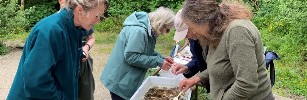
Volunteer citizen scientists carry out regular Riverfly and monitoring through the West Country Rivers Trust’s Citizen Science Investigations (CSI) to produce monthly reports.
Who is involved and what is their role?
f
 Lady Rashleigh Mine testing site (Luxulyan Valley)
Westcountry Rivers Trust (WRT) Citizen Science Investigations (CSI) volunteers
Friends of Par Beach (FoPB)
Friends of Luxulyan Valley (FoLV)
Environment Agency (EA) Analysis and Reporting (A&R) team, and catchment coordinator.
Westcountry Rivers Trust (WRT)
Outcomes / learnings The groups and volunteers involved in this project are very proactive and self-motivated. Data are mostly collected monthly, providing a consistent story over time. Comparison of different sites across the catchment is more useful than absolute values given by the field test kits. Data provided by the citizen scientists is of relatively high resolution in terms of both location, time and frequency, a useful supplement to EA monitoring. Citizen science reports have added valuable supporting evidence to existing EA knowledge of specific water quality issues and have raised awareness of these issues among citizen scientists.
| Successes
Collaborative working has enabled the EA to suggest additional low risk CSI and Riverfly monitoring locations to the groups that would provide additional evidence for suspected or potential pollution sources. Citizen science collected data allows the EA and citizen scientists to recognise and celebrate good water quality, as well as highlight developing issues. Data visualisation tools within reports enable EA to view findings ‘at a glance’ rather than analysing the raw data. Long term data charts using different timeframes (from April 2022 and from April 2023) enable identification of long term and recent patterns in the data. Multiple water quality issues have been highlighted by the citizen science reports. |
Challenges
Identification of safe, accessible and low risk testing sites downstream of potential pollution sources has been challenging. Maintaining volunteer motivation and continued regular data collection. | Solutions Encouraging consistent citizen science monitoring. Providing as much feedback as possible to the volunteers on how the data is being used. |
Project links
Find out more about the Environment Agency’s Supporting Citizen Science project
Current information on Water Framework Directive water quality classification