
Local flood history
How flood risk is changing
Climate change is causing more extreme and unpredictable weather patterns, increasing the risk of flooding. Local responses are, therefore, increasingly more important.
We are here to help local residents and businesses take more control of flood risk and reduce its impact. Meaning you get back to normal as quickly as possible.
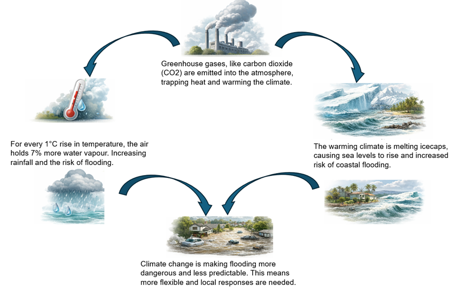
What is the local flood history?
Ealing's flood risk
Flooding in Ealing comes from several sources, including rivers, surface water, groundwater and sewers. The highest risk is from surface water flooding (also known as flash flooding).
Surface water flooding, flash flooding, happens when heavy rain cannot drain away. Recent data shows that over 320,000 properties in London (link opens a new window) are at high surface water flood risk.
We encourage you to check your flood risk (link opens a new window) and know how to prepare.
What is going on to reduce local flood risk?
Ealing Council are gathering data around flooding to identify the areas most prone to flooding in the borough.
You can find more about Ealing's response to flood here:
https://www.ealing.gov.uk/download/downloads/id/4917/local_flood_risk_management_strategy.pdf
How can I learn more about flood risk?

The British Red Cross offer online and in person workshops to build your confidence, knowledge and skills so you know what to do before, during and after a flood.
Who is responsible for managing local flood risk?
Roles and Responsibilities
Ealing's flood risk is complex, and who is responsible for managing the different causes of flooding is also complicated. To help, we have teamed up with Ealing Council to create this breakdown of responsibilities. Please note, by responsible we refer to managing the flood risk and not responding to incidents, this falls to the emergency services.
| Authority | Responsibility |
| The Environment Agency | Manages flood risk from Statutory Main Rivers, like the Brent and Yeading Brook. |
| Ealing Council | Manages flood risk from Ordinary Watercourses, see the Flood Hub(External link)(External link) (link opens a new window) for more information on Ordinary Watercourses and Statutory Main Rivers. Responsible for responding to surface water (flash flooding) and gullies, drainage pipes and assets within the highway boundary. Click here for further information regarding surface water management: Ealing Flood Risk Management Plan (link opens a new window) |
| Thames Water | Responsible for public sewers and water provision. See Thames Water's(External link)(External link) (link opens a new window) website for information on avoiding blockages. |
| Highways Agency | Responsible for managing flood risk on A406 and A10. |
| Canal and River Trust | Responsible for managing navigational canals such as the Grand Union Canal by monitoring water levels and removing excess water. Find out more here (link opens a new window) |